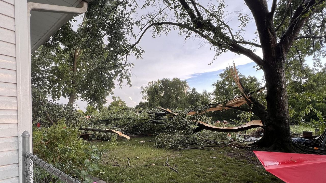
The unsettled weather over the weekend brought severe storms that toppled trees and power lines. The hardest hit parts of the area are still dealing with power outages, which may continue to be the case for a few more days.
A warm front will lift through the region this morning, bringing a return to low-level moisture, including our dew points. A cold front will approach from the west during the afternoon, with showers and storms breaking out ahead of it.
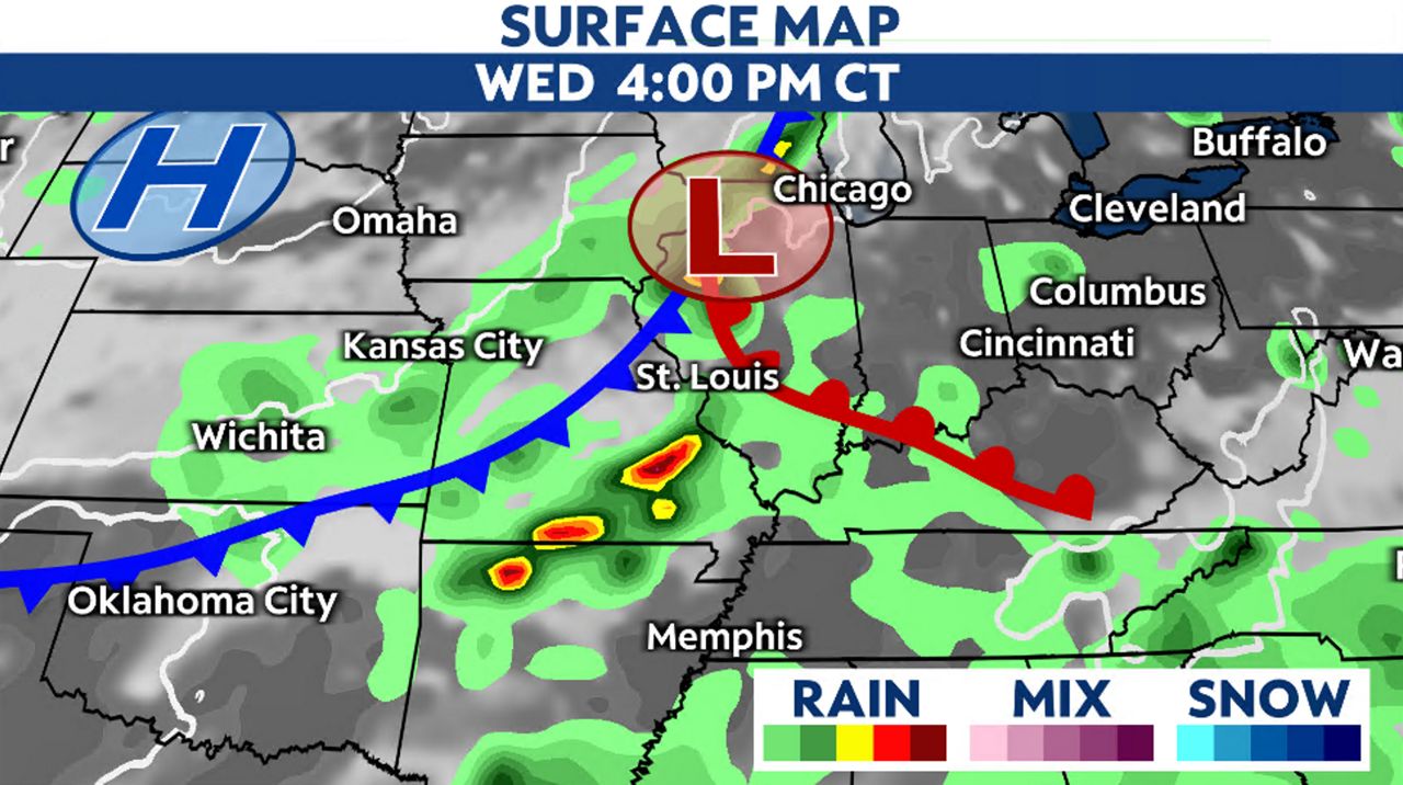
A warm and unstable air mass will set up the potential of severe storms later on Wednesday. The more sunshine we receive in the morning will aid in fueling these storms.
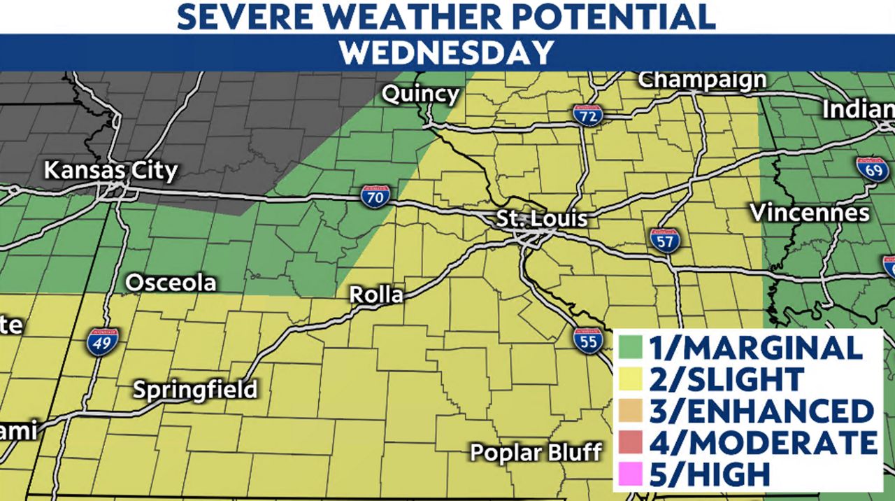
The Storm Prediction Center (SPC) has the region under a slight risk (level 2 out of 5) for severe weather. The biggest threats include damaging winds and large hail.
Storms will develop midday and move east through the afternoon. By the evening, most of the storm activity will be south and east of the metro, but some showers may still linger.
Just like the weekend storms, any activity could produce heavy rain. Some parts of the area received 1 to 3 inches of rainfall over the weekend, so additional rainfall could cause flooding.
The good news is that behind this front, cooler air will move into the area Thursday through the rest of the week. Highs during the day will be in the mid-80s and lows in the mid-60s- a nice July treat.
Although, more active weather is expected to return in time for the weekend.
Our team of meteorologists dives deep into the science of weather and breaks down timely weather data and information. To view more weather and climate stories, check out our weather blogs section.


)