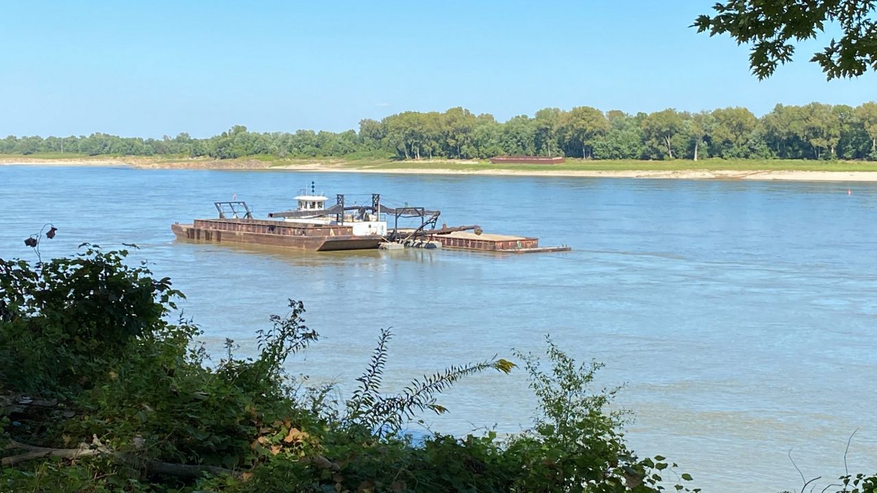
Last week, water levels along the Mississippi River near Hickman, Kentucky dropped too low, suspending ferry service across the river between Kentucky and Missouri. As of Sept. 20, the ferry remains closed until further notice due to low water levels, according to the Dorena-Hickman Ferry’s Facebook page.
St. Louis sits close to the confluence of the Missouri and Mississippi Rivers. Both rivers provide important agricultural, economic and leisure boosts to the region. For the area, healthy river levels not only help maintain those benefits but also provide transportation both across and down the rivers.
Viking Cruise Lines recently launched the Viking Mississippi, a 450-foot long cruise ship to travel the Mississippi River between the New Orleans and Saint Paul, Minnesota with a stop in the St. Louis area. As of now, the luxury ship has not had to delay trips, but it is dependent on healthy river levels.
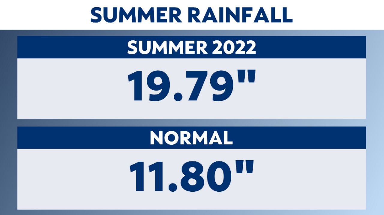
July and August showed extreme rainfall totals in the St. Louis region. However, most of that rain occurred during three major weather events.
This means, while the heavy rain provided saturation along the zone of aeration in the short-term, the water table, which elevated to an adequate level after each event, fell as the soils dried once again.
I spoke with Senior Hydrologist Mark Fuchs at the St. Louis National Weather Service about the current levels of both the Missouri and Mississippi Rivers. He explained that the Corps- St. Louis District is getting concerned with the navigability of both rivers heading into fall.
“According to the USGS, the flow percentile on the Missouri River at Hermann Sept. 19 is only at 8%, meaning for this day of the year, the Missouri at Hermann has only seen lower flows 8% of the historical record on Sept. 19.”
He then added that there isn’t as much navigation on the Missouri River compared to the Mississippi River, saying, “That's where the bigger concern lies.”
However, the flow percentile at St. Louis isn’t as low, sitting at 34% for September. Lower down at Chester, the flow percentile is at 24%.

Fuchs explains that the navigation folks get worried when they see low river levels this time of the year because fall and winter are usually the lowest stages of the rivers, so if they are already low beforehand, that could become problematic.
To remedy the low levels, “this situation will likely require increased dredging by the Corps to keep the channel open over the next few months,” adds Fuchs.
Stressing that navigation isn’t the only low flow concern along the rivers, Fuchs states, “There are also potential issues with water withdrawal for public water supply and power generation at coal-burning plants.”
The only solution to fix this situation is adequate rainfall in both the lower Missouri River basin, below Gavins Point Dam, and in the upper Mississippi River basin across Minnesota, Wisconsin and Iowa.
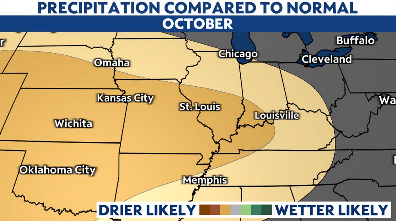
The climate signal for October shows drier than normal conditions, not only in the St. Louis area but also upstream on both rivers.