June is the first month of meteorological summer, which kicks off the three hottest months of the year. With two-thirds of June complete, it has been a hot and dry start to the month.
Let’s look at the statistics so far this month.
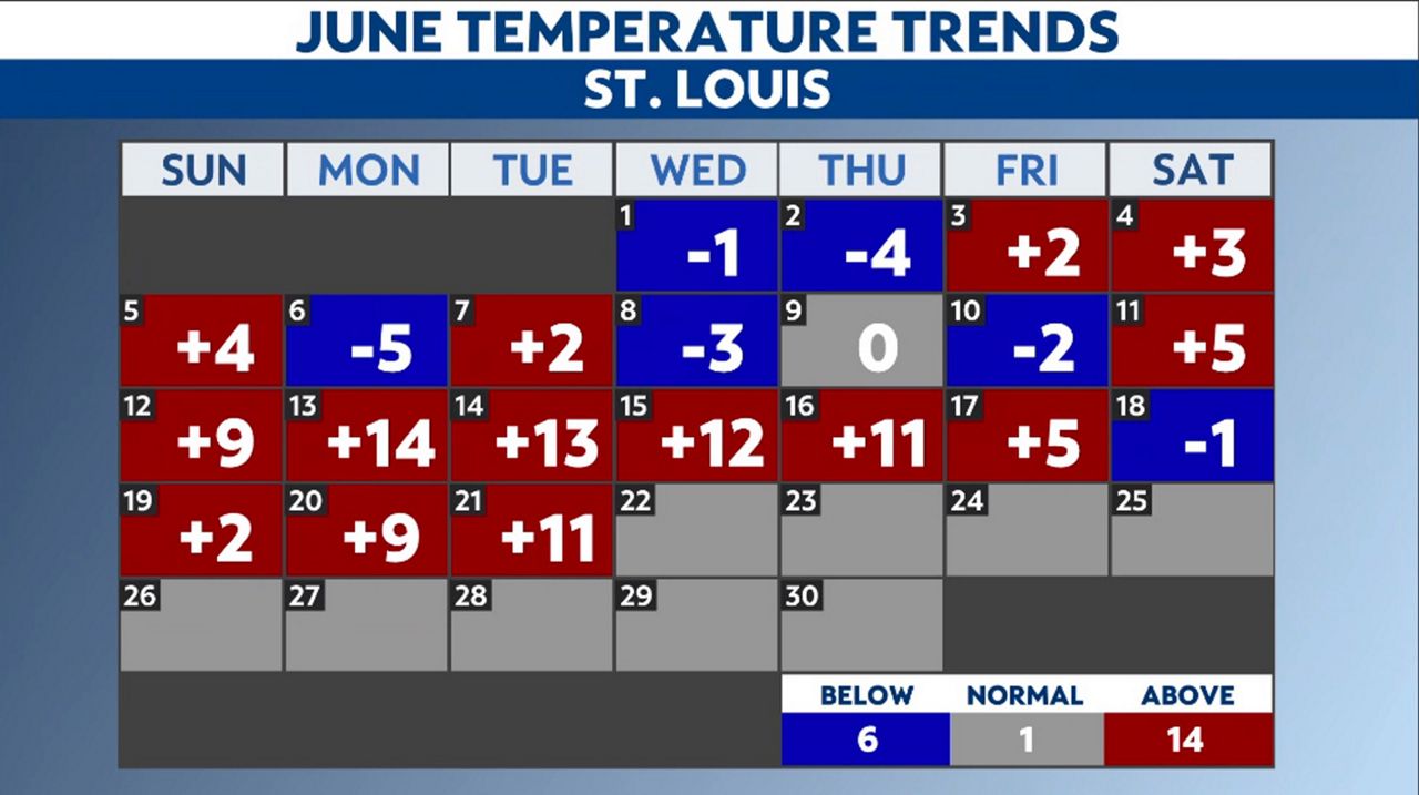
Our warmest day occurred on June 13, when we broke the daily record high with 100 degrees. It was the first time the St. Louis Lambert International Airport recorded a high in the triple digits since Aug. 25, 2021.
The coolest day of the month was on June 6, when the temperature stayed in the 70s, with a high of 79 degrees.
Overall, we’ve observed 14 days above average, six days below average, and one day where we hit our average high for the day.
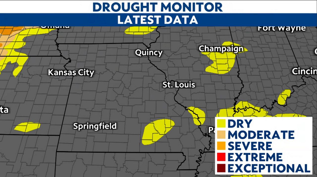
Not much rain has made it to our side of the “Show Me” state this month. In fact, we’ve only seen 1.31” of rainfall so far, which is less than half of our average.

However, we aren’t concerned about drought conditions yet, thanks to a wet May and overall wet meteorological spring. We entered the month of June with a surplus, but looks like we will end with a deficit.
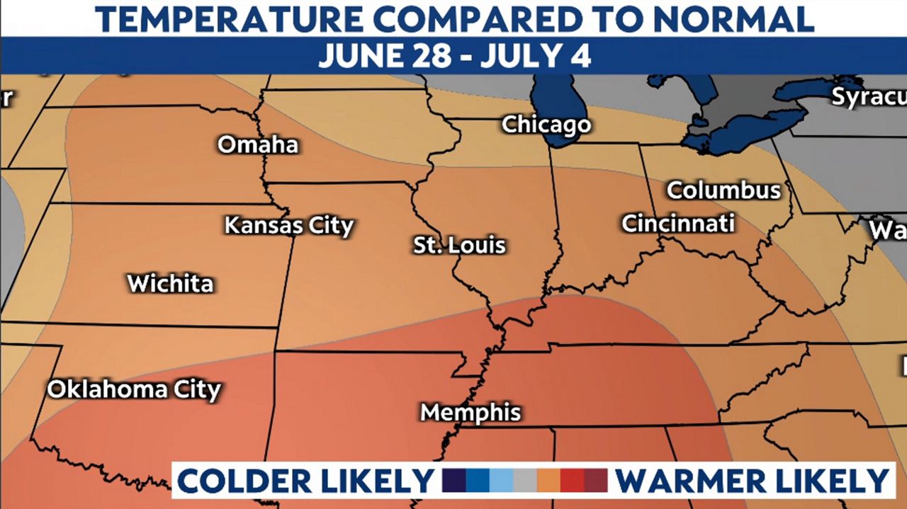
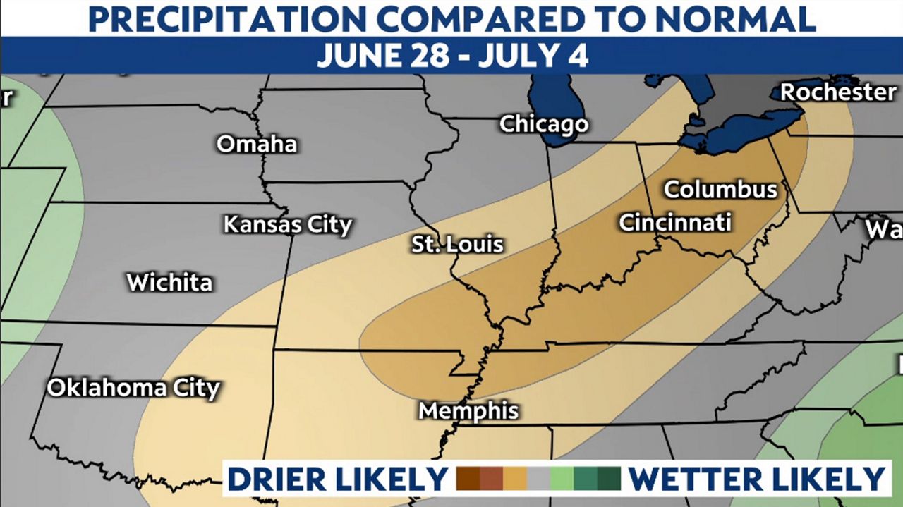
The forecast doesn’t look to offer much heat or rain relief. Warmer than average temperatures with drier than normal conditions are likely into the first few days of July.