ST. LOUIS — At least four tornadoes touched down in the St. Louis metro area on Thursday. With more surveys planned by the National Weather Service (NWS) in St. Louis.
A Severe Thunderstorm Watch for the entire St. Louis area was issued Thursday afternoon through the evening, ahead of an approaching cold front. Thanks to warm and moist air ahead of the front, along with sunshine, the line of thunderstorms intensified as it reached east-central Missouri.
Just before 5 p.m., tornado warnings were issued, and the sirens were activated for the western counties, including St. Charles and St. Louis counties. Around 5:30 p.m., NWS messaged about observing a tornado on the radar, located west of High Ridge in Jefferson County, as well as rotation in a storm just south of Eureka, Mo.
A warning went out for both locations and residents were urged to take shelter. A few minutes later, another tornado warning went out for the densely populated Fenton and Arnold areas.
The storms remained severe and continued to show signs of rotation on the radar. Tornado warnings were issued for the counties on both sides of the Mississippi River.
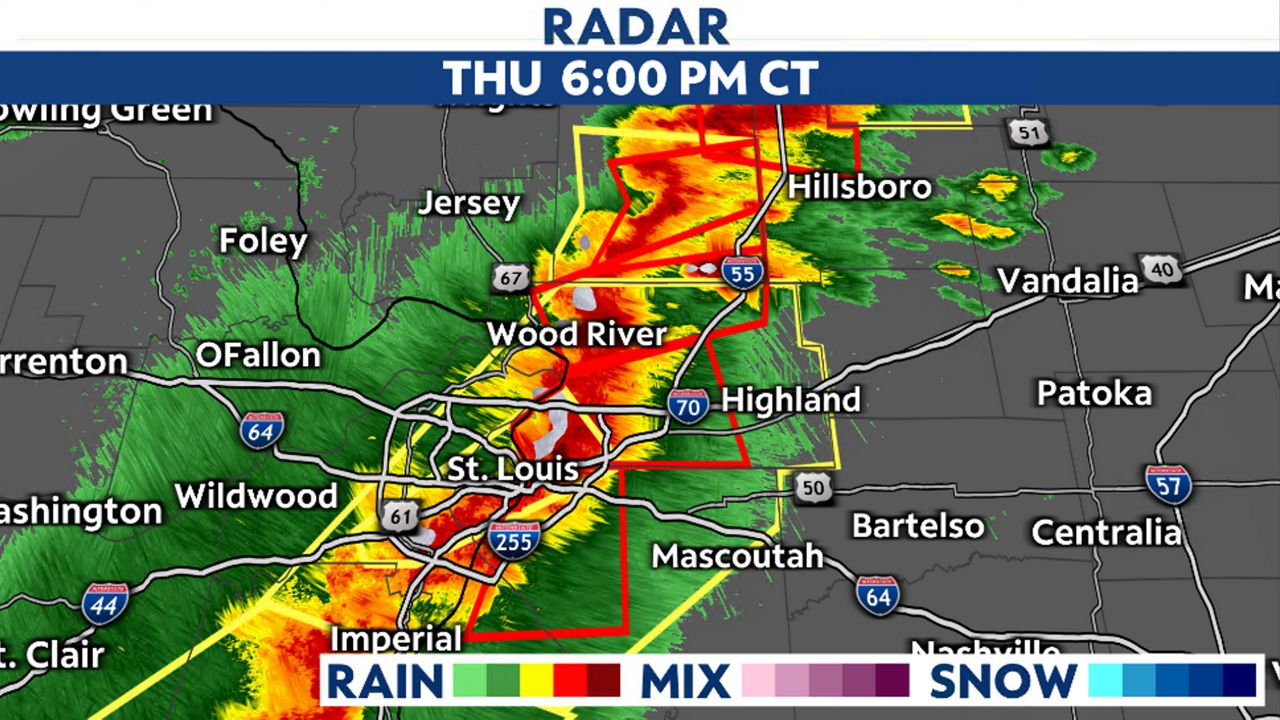
Tornado Warnings continued through the evening until around 7 p.m. when the storms moved out of the viewing area. Damage was reported to NWS and surveys were planned for Friday.
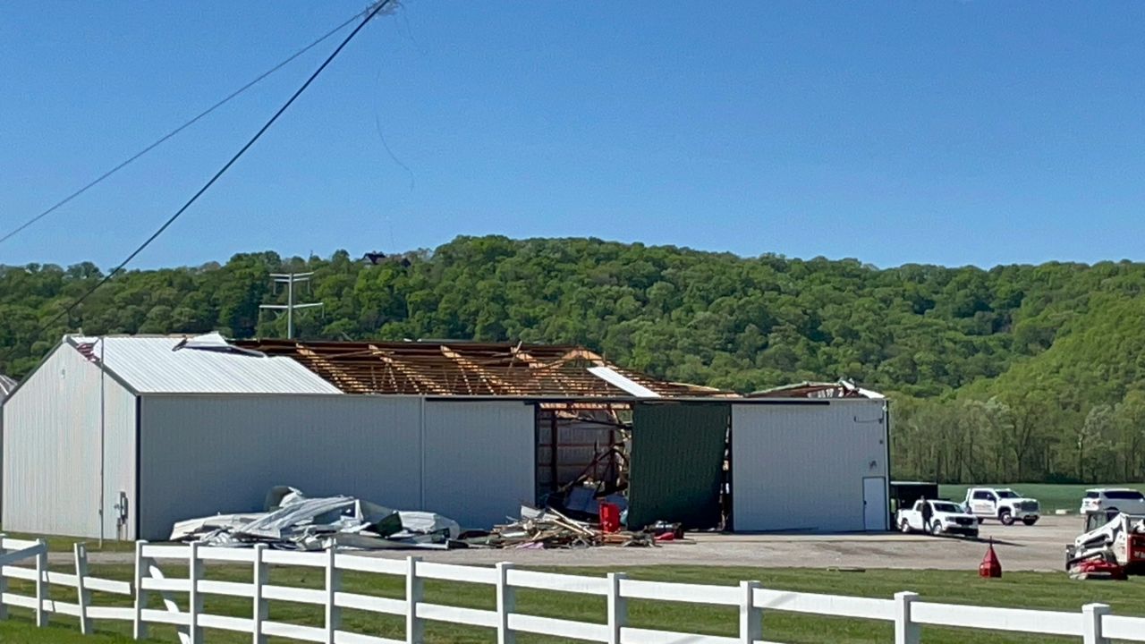
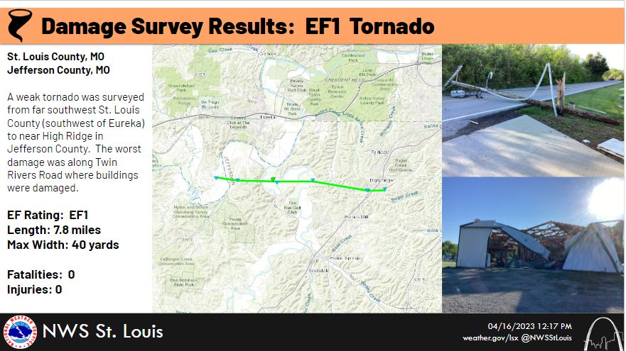
With winds estimated at 100 mph, a tornado touched down southwest of Eureka and stayed on the ground for 7.8 miles before lifting back right near High Ridge. The worst damage was Brookdale Farms, a 300-hundred acre farmland, popular for weekend getaways and weddings, where a building was damaged.
The tornado was on the ground for nine minutes, from 5:30 p.m. to 5:39 p.m.
A weak tornado touched down in Madison County, Ill. The tornado was on the ground for seven minutes and had winds estimated up to 80 mph.
Some tree damage was along Lower Marine Road and shingles were blown off a roof near Marine. The tornado traveled nearly seven miles.
Another EF0 tornado touched down south of Pontoon Beach, Ill. Winds were estimated at 80 mph and tree damage was found along Arlington Road.
The tornado was on the ground for one minute and had a length of 0.3 miles. The damage in Marine, IL itself was straight-line winds.
42824.png)
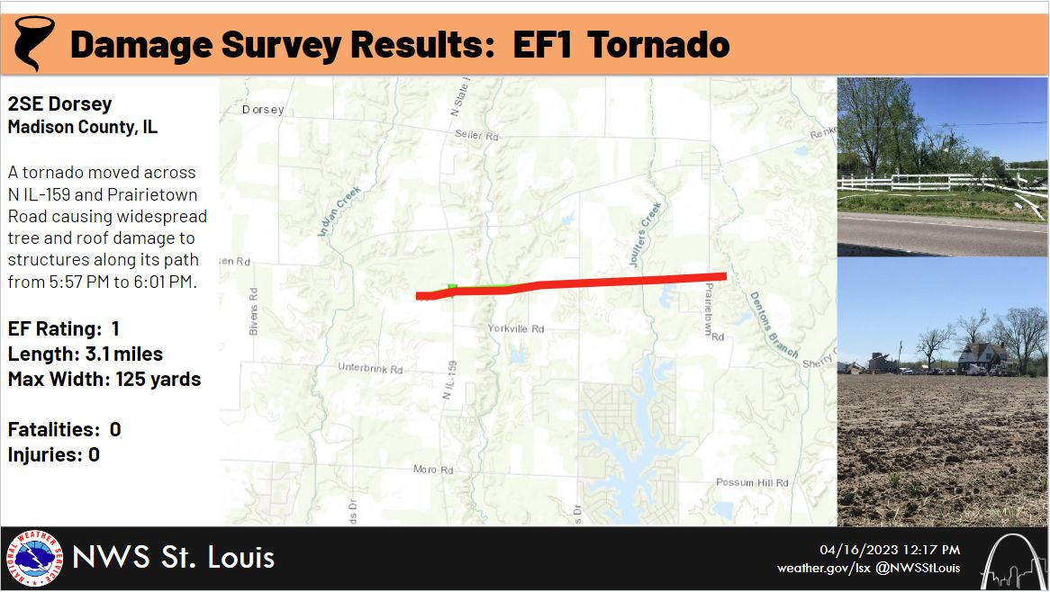
An EF1 tornado touched down in northern Madison County, Ill., southeast of Dorsey. It had estimated winds to 95 mph and produced widespread damage to trees and there was roof damage to structures along its path.
It was on the ground for four minutes and traveled just over 3 miles.