


The remnants of Philippe will merge with an incoming cold front to bring us wet and locally windy weather this weekend.
While it doesn't look as impactful as Lee was in mid-September, flooding and numerous power outages are possible through Saturday night and into early Sunday morning.
Plan on rain showers to start developing by early Saturday ahead of an incoming cold front. Those will gradually become steadier and more widespread as the day goes on, especially later in the day.
Moisture increases Saturday evening and night as the remnants of Philippe come ashore. Rain will be the heaviest during the night, particularly in eastern Maine. As the system pulls away on Sunday, rain will eventually scatter away and lighten.

Most of the state currently looks like it will pick up between 1 and 3 inches of rain, with the higher totals happening in eastern Maine. Locally higher amounts exceeding 3 inches may also fall there.
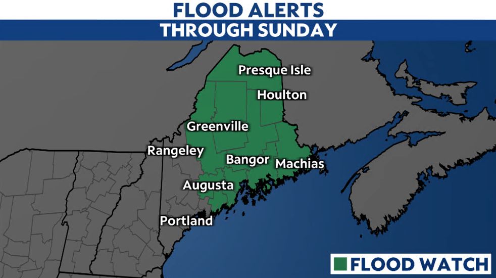
Heavy rainfall and excessive runoff could lead to flooding in creeks and streams. Fallen leaves could also lead to poor drainage, increasing the likelihood of flooding.
Much of the state is under a Flood Watch through Sunday.
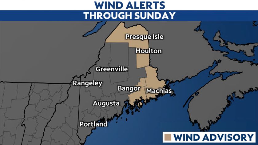
Winds will increase on Saturday and stay gusty into Sunday. The strongest winds will mostly affect eastern Maine and areas closer to the coast, where gusts could reach up to and over 50 mph late Saturday night into Sunday morning.
A Wind Advisory was issued across eastern Maine Saturday evening through Sunday morning.
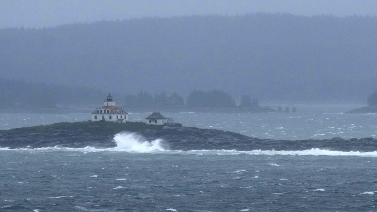
As far as marine and coastal impacts, swells will increase with offshore seas probably topping 10 feet, according to the National Weather Service. As a result, High Surf Advisories have been issued along the entire coast of Maine on Sunday.
Coastal flooding is unlikely, though.
Our team of meteorologists dives deep into the science of weather and breaks down timely weather data and information. To view more weather and climate stories, check out our weather blogs section.