


Post-Tropical Cyclone Lee will bring rain, wind and waves to Maine on Saturday. Tropical alerts are in place for portions of the state.

Lee has made landfall in western Nova Scotia on Saturday afternoon.
Even though the center of Lee is expected to stay east of Maine, the massive storm's impacts will be far-reaching. Much of the state will feel the bulk of its effects on Saturday.
Fortunately, this storm will be a fast mover, and by Sunday, conditions will be much better.
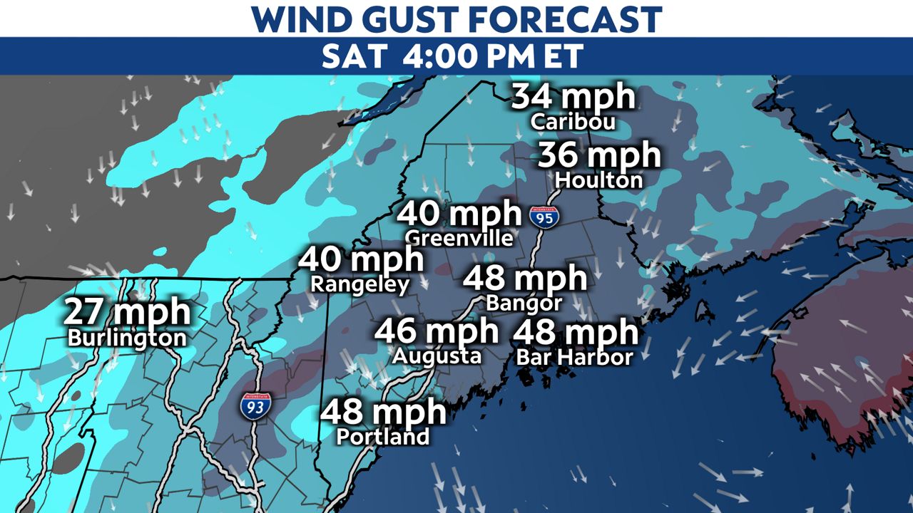
Winds will continue to increase, with the strongest winds lasting throughout the day Saturday. Sustained north to northeast winds will generally blow at 20 to 30 mph, with higher speeds near the coast.
However, gusts will be stronger. These should top 40 mph for nearly the entire state, with some seeing peak gusts around 50 mph. Again, expect the highest gusts in coastal areas. That'll especially be the case on the Downeast coast, where the highest gusts may be closer to 60 mph or higher.
These winds will cause areas of tree damage and power outages. The strong winds alone would be enough to knock down tree limbs, but wet ground could allow some trees to tip or come down.
According to poweroutage.us, more than 50,000 customers in Maine are out of power as of early Saturday evening.
Rain will continue to spread in from the south on Saturday morning, and most of the state should be getting rain by early afternoon. Some of the rain will turn heavy at times, and will diminish Saturday night. Leftover showers in eastern Maine taper Sunday morning.
Exact rainfall amounts will depend on where Lee ends up tracking. The eastern half of Maine will come away with the highest amounts. In particular, Downeast Maine should see at least 2 to 3 inches. Amounts will be lower toward the New Hampshire border.

How much you get will depend on exactly where Lee ends up going and where the most persistent bands of rain set up.
Since our ground is wet, this rain could cause flash flooding. Streams and poor drainage areas would be most susceptible to water issues.
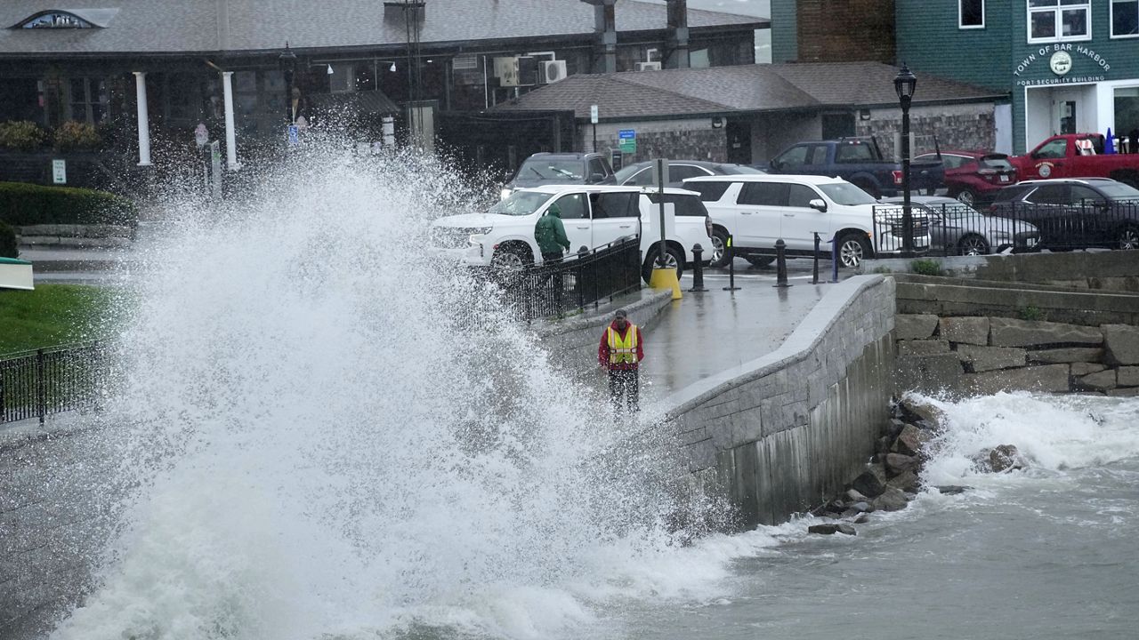
High surf and rip currents are already buffeting the coast, and northerly seas will increase going into Saturday.
Swells build over 15 feet and the National Weather Service advises that considerably higher waves are expected. They warn of sneaker waves, "sets of larger waves that come up much further and faster than the rest, resulting in very dangerous conditions along the beaches and rocks."
Coastal flooding is likely during high tide, where Coastal Flood Warnings are in effect for portions of the Midcoast and Downeast. Coastal Flood Advisories are in effect along the rest of the Midcoast and southern coast.
Storm surge of up to 1 to 3 feet above ground will be possible on the coast. This, along with the high surf, will cause beach erosion in vulnerable locations.
Conditions will improve on Sunday, but seas should still be somewhat rough.
Our team of meteorologists dives deep into the science of weather and breaks down timely weather data and information. To view more weather and climate stories, check out our weather blogs section.