We're in for an awfully wet and windy end of the week, and rain may be heavy enough to cause local flooding.
Check the latest radar here and turn on your Spectrum News app weather notifications so you’re alerted to any warnings.
A Flood Watch covers all but the Crown of Maine through Saturday morning due to the threat of heavy rain. There will be less rain in the far north, limiting the chance of flooding.
Rain today will be fairly steady statewide, falling heavily at times. It’ll taper off in western Maine in the afternoon, with the back edge slowly working eastward. Rain in far eastern Maine probably won’t end until closer to daybreak Saturday.
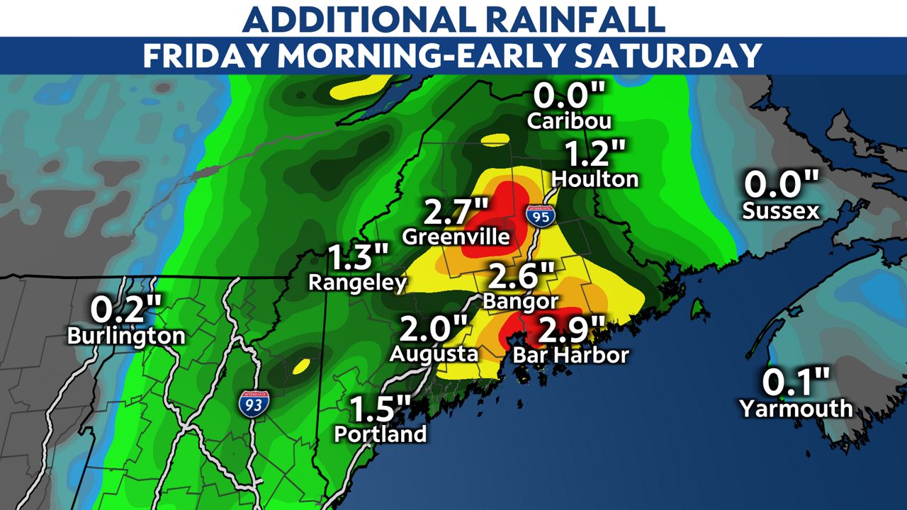
Widespread rainfall totals amounting to one to three inches is likely. Some localized amounts over four inches are possible, especially in the mountains and foothills.
Below is a forecast of additional rainfall from Friday morning through early Saturday, above what's already fallen.

Heavy rain will cause some creeks and streams to rise, possibly leading to pockets of flooding. Flooding is also possible in urban areas and where drainage is poor, especially if fallen leaves clog storm drains.
Be on the lookout for pools of water forming on roads. The rain will already make some roadways slick, but they'll be especially so where leaves have accumulated.
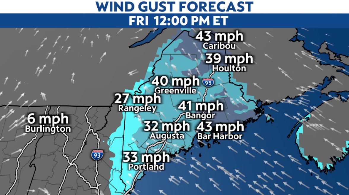
Stiff winds blow throughout the state, with many having gusts near or above 30 mph. Favored areas in the higher terrain and on the Downeast coast may see gusts as high as 45 to 50 mph.

Winds gradually diminish from west to east later Friday into Friday night.
Isolated power outages may occur if limbs fall onto lines. This period of wind will also probably put an abrupt end to the foliage season.
A Gale Warning is in effect Friday for all of Maine’s coast. Southeast winds of 15 to 30 knots will gust up to 45 knots. Expect seas of 6 to 11 feet, with seas of 5 to 8 feet on intra coastal waters.
Hazardous seas will reduce visibility and could damage vessels.


