


There comes a time during every season the calm turns upside down and activity increases. The month of June, especially for tropical regions, signifies the start of hurricane season.
These massive storms, which at their most intense, bring catastrophic damage as a category 5 hurricane, with wind speeds at 157 mph or stronger.
Since records began in 1851, there have been 5 category 5 hurricanes in the Atlantic basin. So, there have not been too many, but a hurricane doesn’t have to reach a "cat 5" to bring devastating effects.
Not only are the tropics a nice place to vacation, but it is also the prime location for hurricane development.
Water temperature plays a major role in hurricane development. These storms usually form in water at 80 degrees or higher. The warm water leads to evaporation which then condenses and forms clouds.
The condensation of water droplets then leads to the release of heat.
As Meteorologist John Cannon from the NWS states, "warmth in the cloud leads to a lowering of pressure (warm air weighs less than cold air). Air tends to rise towards this area of low pressure in the lower to middle portion of the atmosphere. More and more air moves towards this area of low pressure, which can go from a disturbance to a tropical depression and then to a tropical storm and finally a hurricane. The system begins to spin due to the rotation of the earth."
Most hurricanes form in August through October, with the most occurring in September. Makes sense right? These months have some of the warmest water temperatures. The question though is why do hurricanes lose momentum before getting to Maine.
There are a few reasons behind this, one of which is the water temperature.
If you have been in the ocean water along the coast of Maine, I am sure you noticed it doesn’t get close to 80 degrees, even during the hottest months. The average warmest temperatures for waters in the Gulf of Maine are around 60 to 70 degrees. This is not nearly warm enough to sustain a powerful hurricane.
Another factor is Maine is tucked away inland, so as a hurricane makes its way up the coast, areas such as Long Island, N.Y. and Cape Cod aid in the hurricane losing energy. This being because a hurricane needs warm water to last. As it moves across land, it will weaken.
Area of Downeast Maine jut out more into the Atlantic, which makes those locations more susceptible to the impact of a hurricane or its remnants.
Even though it is not likely for a hurricane to hit Maine, it is far from impossible.
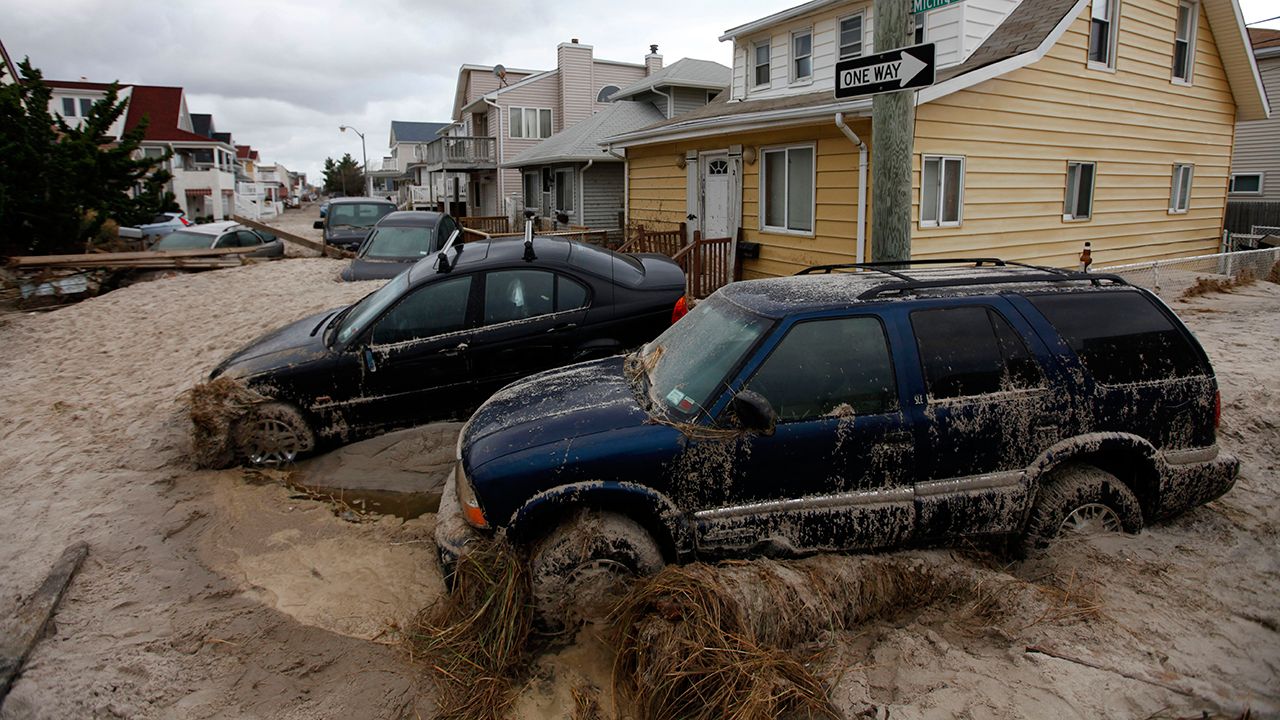
Hurricane Sandy was the last to impact Maine. The remnants of this storm caused high winds and a storm surge high enough to lead to coastal flooding.
In 1954, Hurricane Edna caused devastating flooding in Maine, which resulted in 8 fatalities. Edna was also the costliest hurricane in the state’s history.
In 1991, Hurricane Bob barreled up the Northeast coast, hitting Block Island as a category 2 storm, then making landfall in Rockland as a tropical storm. This hurricane brought wind gusts at 92 mph and 8 inches of rain in just 36 hours.
Though not impossible, these powerful storms do and have made an impact, all the while losing strength and intensity.