


Blue skies we saw Wednesday will continue to be clear tonight, leading to a frigid start to Thursday morning.
Temperatures are largely expected to stay above freezing, but it will still be cold enough for patchy frost to form across much of the Triangle.
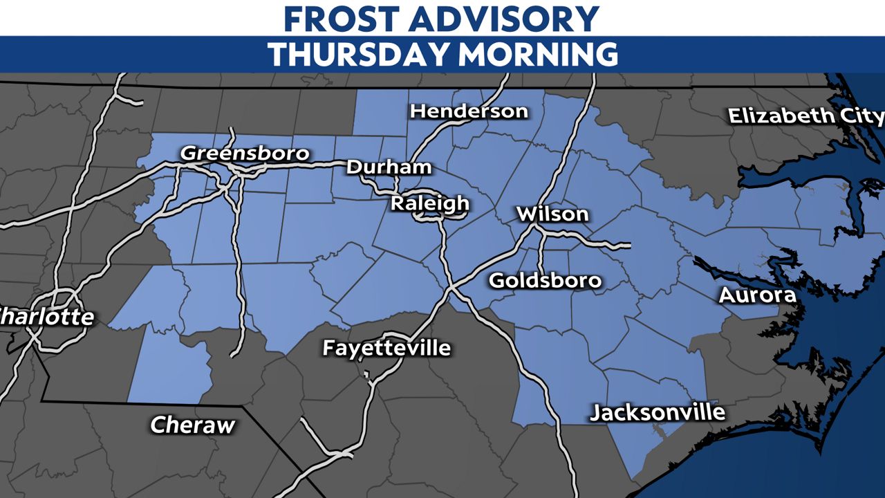
If you're in these areas and have sensitive plants outside, it would be a good idea to bring them inside or to cover them tonight.
Temperatures will drop to the 30s by sunrise.
Plenty of sunshine is expected Thursday, too, with similar temperatures to what we had Wednesday. We'll get into the middle and upper 60s at the warmest point of the day.
-3)
Warmer temperatures are expected by the end of the week and into the weekend, but rain looks unlikely until showers and thunderstorms arrive early next week.
Check radar and the latest 7-day forecast | Share your weather photos