


City officials in Biddeford know that ongoing growth and development are going to make traffic worse, and they are betting a new study will help them understand how to deal with it, especially on Route 111.
“The purpose of the study is to think through the best options,” said Matthew Eddy, Biddeford’s director of planning and development.
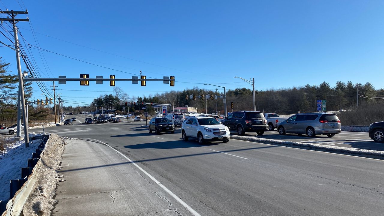
The study, conducted by T.Y. Lin International, will examine the Route 111 corridor through the city, including Exit 32 off the Maine Turnpike which leads drivers onto the Biddeford Connector. Tom Errico, a senior associate and engineer with T.Y. Lin, said work on the study officially began in August, but the town first unveiled it in a public meeting on Dec. 14. The city is partnering with the Maine Turnpike Authority and the Maine Department of Transportation to do the work, Eddy said.
Data from the state Department of Transportation cited in a preliminary T.Y. Lin report shows increased volumes in the city near or on Route 111. Average annual traffic volumes, according to the report, went from 25,200 in 2016 to 25,600 in 2019 on Route 111 east of Exit 32. The same report notes traffic on Elm Street (U.S. Route 1) south of South Street, including an intersection with Route 111, also went up, from 12,790 in 2016 to 13,190 in 2019.
The area is potentially dangerous, too. The same report, also citing state data, classified the danger level at various Route 111-related intersections based on accident data collected between 2018 and 2020. The three worst intersections listed were:
Route 111 at Edwards Avenue, near the Five Points Shopping Center (31 crashes)
Route 111 intersection with U.S. Route 1, in front of McDonald’s (46 crashes)
Route 111 where it intersects the Biddeford Connector, just off Exit 32 on Interstate 95 (77 crashes)
“We knew that we had a lot of existing issues along Route 111,” Eddy said.
The study, once finished at the end of 2022, will provide suggestions on how to address traffic problems. Already, officials are considering five possible courses of action: do nothing; employ changes to roads without widening, such as modifying turn lanes and changing signals; broad-based promotion and encouragement of public transit, walking or bicycling; redesign how traffic gets onto and off of Exit 32, and build a highway spur taking traffic to and from another location in the city, such as South Street.
Eddy said the study could lead to one or more of those solutions, or even suggest others no one has thought of yet. One thing is certain: The study itself is only informational. He and Errico both stressed that officials will still make the ultimate decision on what to do after the study is finished.
“This study isn’t going to conclude, and then the bulldozers come out,” Errico said.
It is likely that any solution will include encouraging bicycling and walking, Errico said, as that matches what other municipalities are now doing statewide, from larger communities such as South Portland to towns like Millinocket, which is studying how to make walking and biking safer on its streets.
As to what’s driving the trend, Errico cited a few causes, including a growing interest in health and environmental activism. He also noted an economic component, too, especially in urban areas.
“Not everyone owns a car,” he said.
Errico also said making a community more pedestrian-friendly will encourage people to use mass transit, be it by bus or boat.
“If you want to have successful transit, you’ve got to have walkable access,” he said.
Both Errico and Eddy said making traffic improvements now is essential, given the growth in areas such as the mill district, which will only lead to increased traffic burdens in the future.
“We think there are some real opportunities given the density of development and the fact that we are an employment magnet in the area,” Eddy said.