

Part of Northwestern Maine remains in a severe drought, prolonging a dry period that began in 2020.
The most deep-set dryness is in northeastern Oxford County, northern Franklin County and northwestern Somerset County. That area of severe drought shrunk very slightly from last week and now covers about 5% of the state, according to Thursday’s weekly update from the National Drought Monitor.
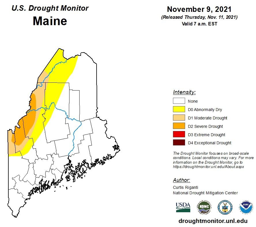
Abnormal dryness and moderate drought surround that area and extend into western Aroostook County and northwestern Piscataquis County. The drought monitor estimates that nearly 60,000 Mainers live in the drought-affected region, which comprises about 27% of the state’s area.
The conditions haven’t changed much in the past few weeks, but drought was more widespread in late summer. A larger area of Maine, including most of Aroostook County, was in a much deeper drought a year ago.
The drought monitor says recent rain has helped ease precipitation deficits and moisten dry soils. Seasonal temperatures help too. The Northeast has mostly been cooler than average this week, and the warmest area — near the Canadian border — saw near-normal temperatures.
Still, Maine has now seen worse drought for longer than other New England states. For example, New Hampshire, where the drought was extreme at times in the past two years, is almost entirely back to normal conditions as of this week.
The drought first began to spread early in the pandemic, and has since affected farmers and water users in parts of Maine and elsewhere in New England.