

Torrential rain brought flash flooding to the western islands Monday evening and night, and the threat of flooding continues today.
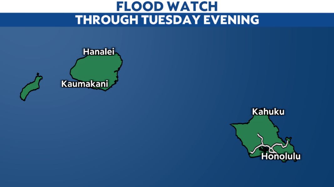
The Flood Watch continues until 6 p.m. this evening for Kauai, Niihau and Oahu. It may be extended, however, depending on how much the rain bands from the kona low move. The Flood Watch has been canceled for the eastern islands as drier air has moved in, ending the threat of widespread heavy rain and flooding.
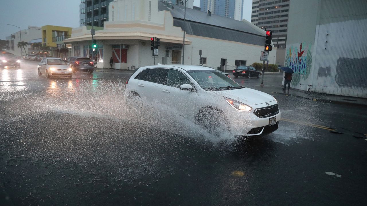
Extremely heavy rain Monday evening and night caused flash flooding, especially in the Honolulu area. The National Weather Service reports several cases of impassable roadways, including H1's westbound lanes near the Vineyard ramp. Flooding has also affected numerous homes and apartment buildings and caused power outages.
Periods of heavy rainfall continue today in the Flood Watch area. Because so much rain has fallen, additional rain will easily cause more flooding. The National Weather Service notes that this much rain can lead to flooding in places that typically don't experience it.
Landslides remain a concern on steep terrain, and debris in runoff could clog bridges and culverts, causing further flooding. Expect additional road closures. Never walk into or drive through floodwater.
Even as the rain eases into tonight, any ongoing flooding will take time to diminish. While areas of showers persist on Wednesday, mainly over the western islands, the flood risk will be much lower. Drier air reaches all the islands on Thursday.
Rainfall amounts over the past couple of days have reached the double-digits in some areas.