


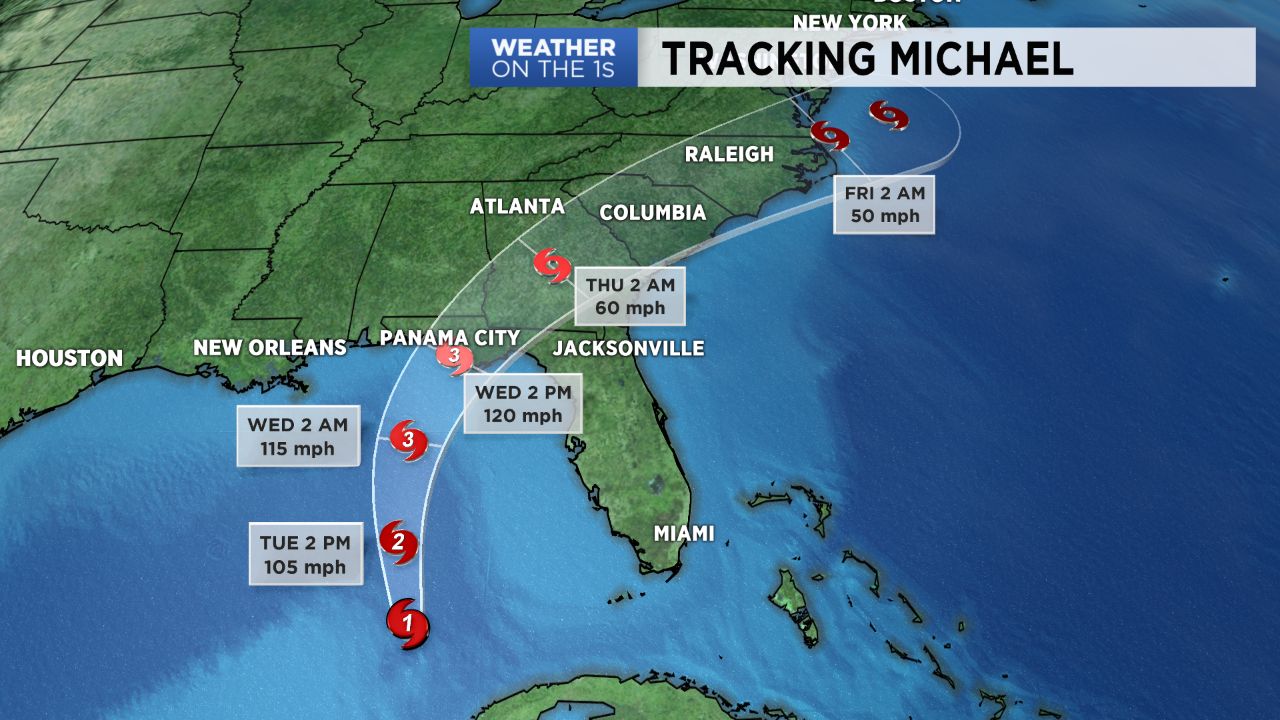
Hurricane Michael continues to strengthen in the Gulf of Mexico Tuesday. It is forecast to make landfall as a category 3 storm along the Florida panhandle Wednesday.
Locations near where the storm makes landfall could experience a storm surge up to 12 feet and destructive sustained winds of 120mph. Isolated areas could also see up to 12 inches of rain.
Michael will weaken as it moves over land eventually tracking over the Carolinas Thursday. That will bring a period of heavy rain and gusty winds to the region.
Moisture will move into North Carolina well ahead of Michael on Wednesday. That will bring scattered storms to the area Wednesday afternoon and evening. A more widespread rain is expected by Thursday afternoon. The storm should be accelerating to the northeast as it tracks over North Carolina, so most of the rain associated with Michael should come to an end by early Friday.
From late Wednesday through early Friday, most of North Carolina should see around two to five inches of rain. Localized totals of up to six inches cannot be completely ruled out.
Since this is much less rain than what eastern North Carolina saw during Hurricane Florence, widespread flooding similar to what was seen after Florence is not anticipated. However, localized flash flooding will be possible for areas that see nearly five inches of rain Thursday.

Wind gusts up to 40 or 50mph will be possible Thursday in North Carolina near where the center of Michael tracks. With a saturated ground, the gusts could topple some trees resulting in spotty power outages.
Isolated tornadoes could also spin up near and to the right of the storm's track.
Stay tuned to Weather on the 1s on Spectrum News for the latest of Hurricane Michael.