


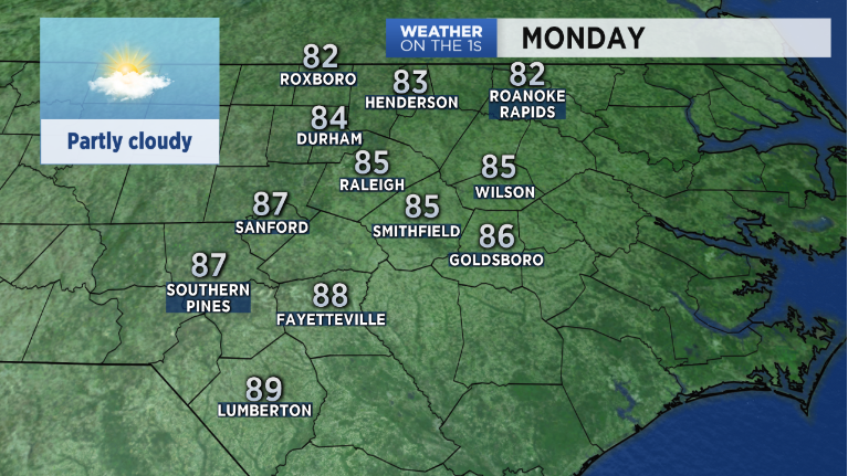
Little change in the weather pattern means little change in the weather for the next few days. High pressure positioned northeast of us will dominate our weather through the first half of the workweek. You can expect above average temperatures to continue through Wednesday. Highs each day will be running near 10 degrees above average; in the mid 80s. Look for mostly dry conditions with isolated showers possible each afternoon as tropical moisture streams into the region.
All eyes are on Tropical Strom Michael down in the southwestern Caribbean. This system will feed off the warm waters of the Gulf of Mexico as it moves north and is forecast to strengthen to a category 1 hurricane late Monday. Landfall will likely take place late Wednesday along the Florida Gulf Coast and as it continues tracking northeast, the Carolinas will be impacted Thursday and Thursday night.
This is a relatively fast moving system so while we will see a good soaking from it, don’t expect anything compared to Florence. Main concerns will be flash flooding for poor drainage areas. As the system progresses over the next few days we'll fine tune the forecast its possible impacts on the Carolinas.
Behind the tropical activity late in the week, a cold front will sweep through the area Friday. Behind the front temperatures look to drop into the low to mid 70s next week. Finally, Autumn will arrive.