


Computer models are great tools for meteorologist when it comes to predicting the weather. However, those models do have their limits.
We're seeing a great example of this with Hurricane Florence.
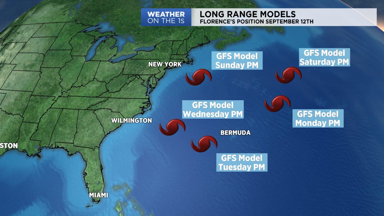
Florence is now a major hurricane, and in recent days, long range model forecasts have literally been all over the map. The American model, the GFS (Global Forecast System), has placed the track of Florence all across the western Atlantic over the past five days. On the map above, you will note the position of the hurricane based on the afternoon model runs of the GFS model during the last five days. The European Model (EURO) has not been much better, forecasting landfalls of the system from Charleston to Washington D.C. and also turning Florence into the Atlantic Ocean.
Bottom line, we really don't know where Hurricane Florence will end up a week from now. The atmosphere is a complex machine and small elements can make for big changes in a forecast, especially when you're tracking a complex system such as a tropical cyclone.
So be wary of any forecast that predicts a specific outcome for Hurricane Florence over the next few days. We should start seeing better agreement with these forecast models as we move toward the weekend and early next week. At that point, meteorologists should have a firmer idea of where the storm may go.
We will continue to keep you posted on Hurricane Florence's forecast and any possible impacts to North Carolina on Spectrum News.