


A big ridge of high pressure remains dominate over the eastern U.S., ensuring our weather remains mostly dry. The small rain chance is due to heating through the day. Above average temperatures in the low 90s along with high dew points in the lower 70s means sporadic isolated storms until sunset.
Tonight expect mostly clear to partly cloudy skies with mild overnight lows in the lower 70s.
Surface high pressure along with the upper level high will dominate through the end of the week. Going into the weekend the ridge will weaken and allow for a cold front to enter the region. This will increase our rain chances especially during the afternoon Saturday and Sunday. Rain chances will remain elevated after the weekend as the front moves through along with a high amount of moisture from the remnants of Gordon.
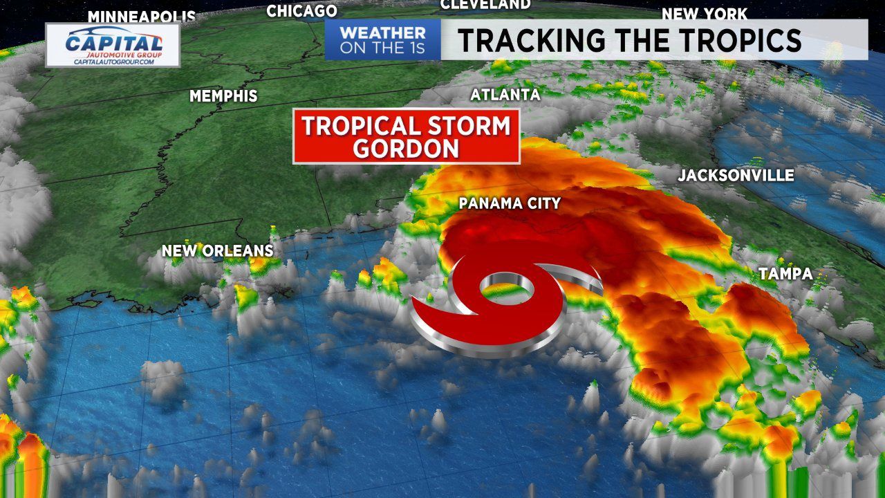
TROPICAL UPDATE:
As we near the peak of the Atlantic Hurricane Season (September 10th), we have a lot to keep our eyes on in the tropics. Gordon continues to gain momentum in the northern Gulf of Mexico, likely making landfall as a weak category 1 hurricane. Landfall will likely fall between New Orleans and Mobile, Alabama. Gordon will then gradually lose steam as it travels northwest over the ArkLaMiss region.
Well to our east over the Atlantic we find what is now Hurricane Florence. The once tropical storm was upgraded to category 1 hurricane status Tuesday morning by the National Hurricane Center. Thankfully, model data suggest this will continue to be a non-issue for the U.S. as it will remain over the middle of the Atlantic through the end of the weekend.
Watch Spectrum News for updates on both storms and a complete look at the tropics.
If you have specific weather questions feel free to follow and ask them on Facebook. All you have to do is click the link below.