


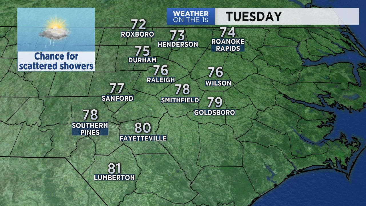
If you're not a fan of hot weather, you are in for a rare June treat Tuesday. A wedge of cooler air over central North Carolina will keep highs in the 70s for much of the region. A few spots in the Sandhills could hit 80.
- Interactive radar
- 7-day forecast
- Share your weather photos with Meteorologist Lee Ringer on Facebook
Along with the cooler temperatures, we will see cloudy skies all day and the chance for a few spotty showers. The highest chance for showers and will come east and southeast of Raleigh. A few thunderstorms with locally heavy downpours will be possible near and east of I-95, but those storms should not be as intense as the storms that developed Monday.
Tuesday's cooler weather will not last long. Sunshine will return Wednesday as a warm front quickly lifts north of the area. That will send high temperatures back to the upper 80s and low 90s for the rest of this week.
Get the latest news, sports and weather delivered straight to your inbox. Click here to sign up for email and text alerts.