


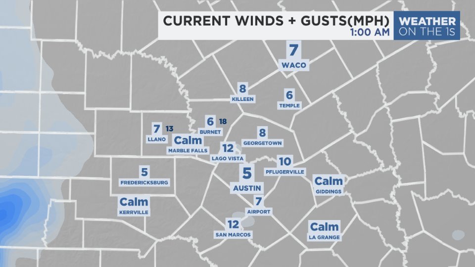
The big weather feature today will be the strong north wind left behind the cold front passing through this morning. Wind speeds will rise to the 15 to 25 mph range out of the N this afternoon ... stronger in Bell and Milam Counties. A WIND ADVISORY will be in effect for the two counties until 5 p.m.
Pre-frontal winds will come from the SW to W at 8 to 15 mph.
Current winds/speeds
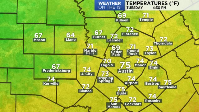
Temperatures at 7 a.m. were, in some locales, warmer than the normal high (70 degrees) for November 18. Highs for the day will occur during the late morning to early afternoon in the upper 70s to low 80s. Temperatures will gradually cool to the lower 70s by the middle of the afternoon. Lows for this day will be established before midnight.
Current temperatures:
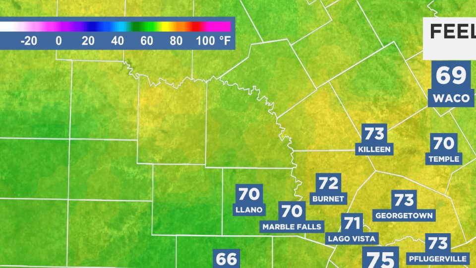
Dew point temperatures remain in the middle/upper 60s making it feel like:
This morning dawned with an overcast sky. Clouds started clearing during the 8 to 9 a.m. hour. The afternoon will be mostly sunny.
Wind speeds will lower overnight. A combination of a clear sky, dew point temperatures in the 30s and low wind speeds will send temperatures dropping to the low to mid 40s tomorrow morning. Sunday will be mostly sunny. Surface high pressure moving to east of Dallas and Waco will provide a NE wind under 10 mph.
Next week is a holiday week. A chance happens Tuesday into Wednesday with the arrival of another cold front. There likely won't be much moisture for this front so, for now, it's a 10% chance of rain Tuesday afternoon to Wednesday morning. Highs drop as much as ten degrees between Tuesday and Wednesday.
Thanksgiving Day is going to be idea. Cold in the morning with upper 30s to low 40s ... mostly sunny in the afternoon with highs in the middle to upper 60s.
For those of you who will begin your holiday shopping Thanksgiving night, a clear sky is expected with a midnight temperature around 50. Your 7 Day Forecast has the Black Friday outlook.
Have a good weekend.