


Some pretty interesting weather will take place this weekend as we say goodbye to Summer and hello Fall.
Fall will officially begin at 9:54 Saturday night and our weather will defintely place us in the Fall spirit.
A back-door cold front will look to dip into the state late tonight and into the day Sunday. Ahead of its arrival expect a warm Saturday will highs in the mid to upper 80s. After a sunny morning, expect partly cloudy skies for the afternoon with a few possible showers. Clouds will continue to build in overhead Saturday night and overnight as the cold front slowly edges closer from the north.
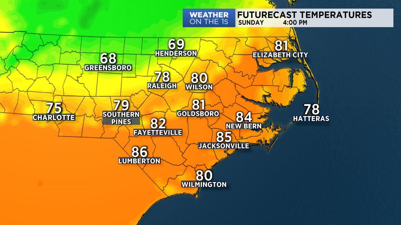
The cold front will likely cut through the state and stall Sunday into Monday. A wedge of cool high pressure will build in behind the front and that will cause a much cooler setting for a big chunk of the state Sunday and Monday. It all depends on how far south the front travels and how big of a wedge develops. The latest trends in the data showed much of the Greensboro and Triad area stuck in the upper 60s for afternoon highs Sunday. For the Triangle highs ranged from near 70 arond Roxboro and near 80 for Raleigh and surrounding locations. Fayetteville and much of the Sandhills areas looks to remain ahead of the front and will likely have warmer temperatures in the low to mid 80s.
The front will likely get pushed to our south Monday as we remain in a below average temperature setting. Highs for many Sunday afternoon will fall somewhere between the upper 70s to low 80s.
During this time keep an umbrella within arms reach due to the possibility of isolated to scattered showers. The best chance for rain will be during the afternoon and evening hours Saturday and Sunday.
Temperatures will rebound back into the mid 80s for many by Tuesday.