


NORTH CAROLINA -- After another day of beautiful, seasonable conditions Monday, temperatures will continue to warm through Wednesday ahead of an approaching weak cold front. Meanwhile off the North Carolina coast, Chris is set to strengthen into a hurricane sometime Tuesday before accelerating to the northeast.
- Temperatures will warm through Thursday.
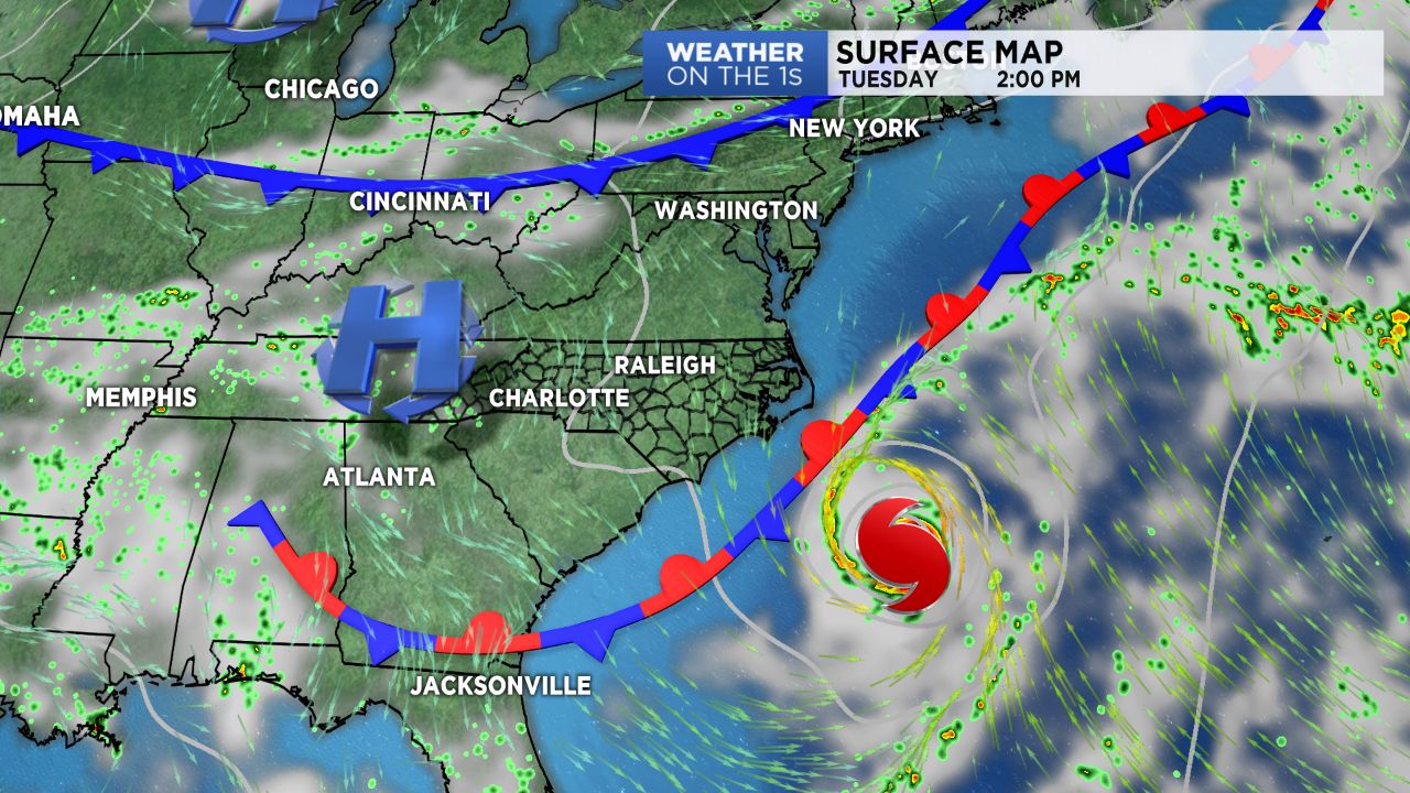
- Tropical Storm Chris will strengthen into a hurricane but remain offshore.
- A week cold front is coming near the end of the week.
While Tuesday will begin off to a cooler than average start, temperatures will warm quickly with many topping off in the 90s once the day is said and done under plenty of sunshine. Humidity will be a tad higher, though still manageable, with dew points in the low 60s. Wednesday will likely be the hottest day of the week before a cold front passes through in the afternoon, bringing a chance for scattered showers and storms late in the day. Behind the front, temperatures will cool back down towards average for the end of the week with an additional storm chance Thursday.
Tropical Storm Chris will begin to slowly drift northeastward off the Carolina coast through the first half of Tuesday, where it is set to strengthen into a hurricane sometime during the day. By Tuesday evening, it will begin accelerating to the northeast and push far to the north of our area by Thursday. While we won't feel any direct impacts across the Piedmont and Triad, beach goers will have to deal with a high risk for dangerous rip currents and rough surf.
Get the latest news, sports and weather delivered straight to your inbox. Click here to sign up for email and text alerts.