


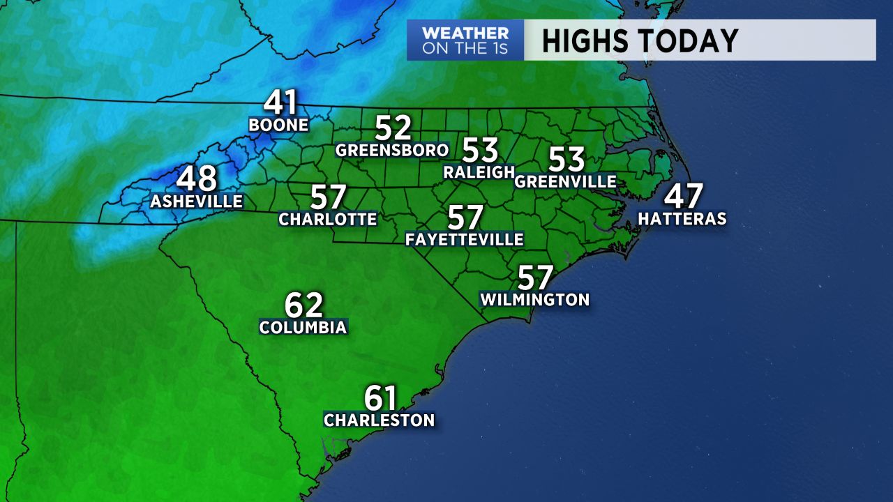
The snow and mixed precipitation from yesterday is gone, and a quiet finish to the work week is on tap for the Carolinas.
Look for good intervals of sunshine today and tomorrow with highs in the 50s. It will be a bit breezy today, but overall, pretty decent weather to finish out the work week.
The weather will then quickly head downhill for the weekend. Our next system will spread precipitation back into the region as early as Saturday morning, and precip should continue through Saturday night and into at least Sunday morning.
A very chilly airmass will build in from the north through the weekend, and highs will struggle to even hit the lower 40s.
I anticipate that once again, some snow will be involved for parts of the region.
At this point, I expect areas roughly along and to the north of I-40 to have the best shot at snow. It does appear there is a chance for some light snow accumulations in those areas later Saturday and Saturday night, but we will need to continue to resolve the finer details surrounding this storm system.
If you want warmer weather, hang on....it's coming. Highs will likely reach into the 70s by the middle of next week.
Get the latest news, sports and weather delivered straight to your inbox. Click here to sign up for email and text alerts.