


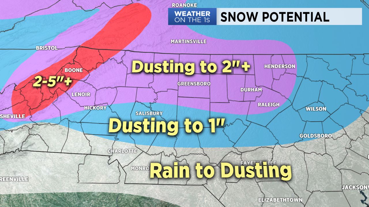
Extremely challenging forecast today. The basic idea is that as an area of low pressure strengthens near the Carolina coast, colder temperatures will continue to get drawn in from the north.
As of just prior to daybreak, snow was flying in the mountains, and the rain/ snow line was in the northern foothills. Through the day, that rain/ snow line will drop southeastward, and most of our area should experience a period of snow.
Ground temperatures that are relatively warm, air temperatures that will likely remain a touch above freezing, and a March sun angle are all negative factors for accumulation with this system.
However, due to the nature of this storm system, there could very well be some bursts or a period of heavy wet snow in some areas that could quickly accumulate. Snow accumulations will primarily be on grassy and elevated surfaces and will likely be extremely uneven.
Anyone in the area could potentially pick up a couple of slushy inches of snow, and other areas will likely receive very little. In the spots that have heavier rates of precipitation, snow will be the primary precipitation type.
However, when the intensity of the precipitation decreases, some light rain or drizzle is likely. This will lead to the uneven snow accumulation amounts.