


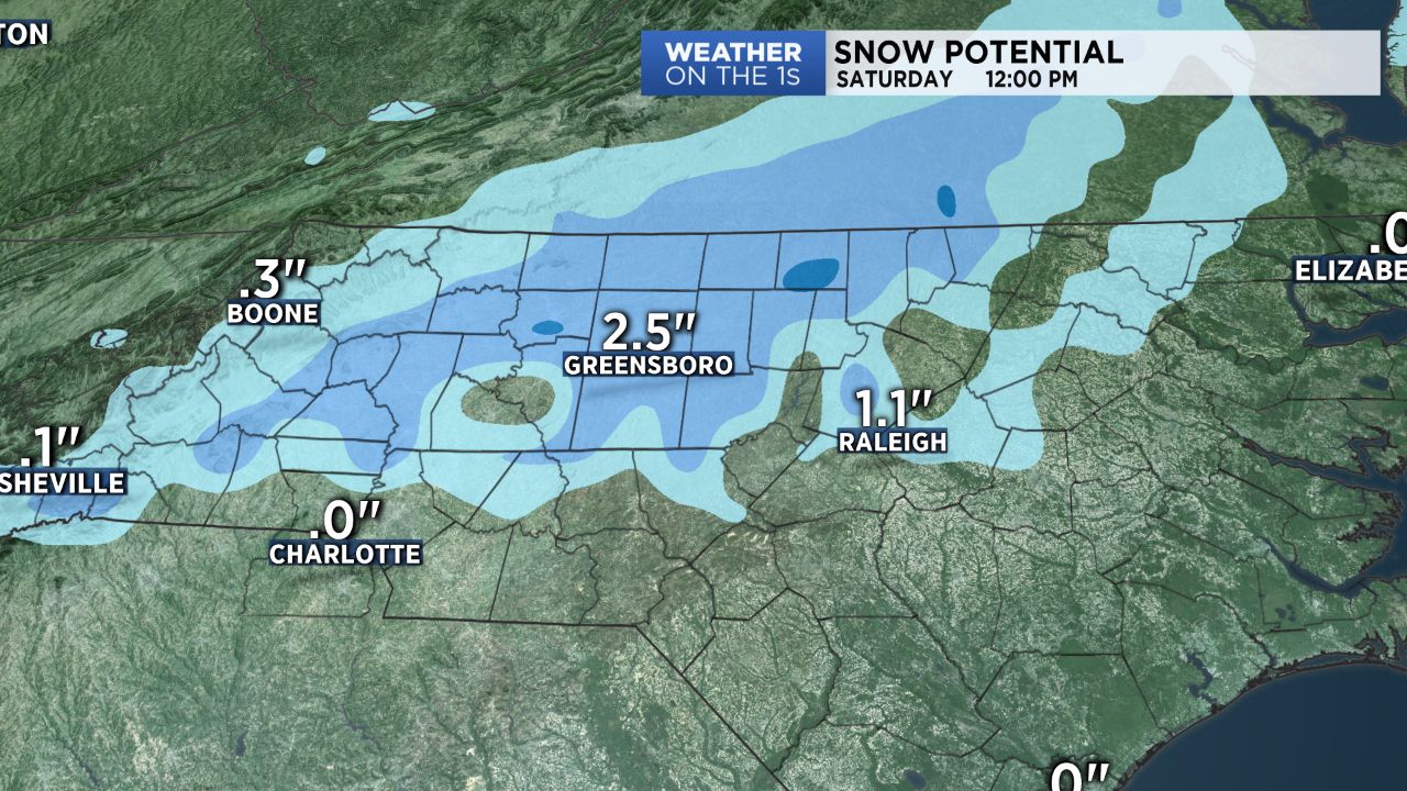
A cold front will stall along the Carolina Coast tonight and then linger through Saturday. Along the front, waves of moisture will track through and near the Triad and as a result passing showers are expected from time to time. In addition, chilly conditions will be in order.
Now, the last wave of moisture is expected to push through late Friday night and early Saturday morning. Colder air will be in place by then, so there is the potential for rain showers to change to snow showers for a few hours. At this point, the main push of moisture will likely still be east of the Triad. That would limit any significant accumulations here, but we could still see some minor totals around an inch or so. However, if the front pushes back inland by a hundred miles or so, that could mean more some.