


A system moving north through the Tennessee River valley Monday will drag its associated cold front through North Carolina Monday afternoon, bringing with it a potentially active day of weather.
After light to moderate showers pushed northward through the Piedmont, foothill, and mountain counties Monday morning, Monday afternoon should prove to be the more active period of weather.
Gusty winds, heavy rain, and severe storms will all be possible as the cold front moves eastward. Winds could gust to near 30 mph across the Piedmont and Triad with higher gusts nearing 40 mph across the mountains.
Rainfall rates will increase as this storm system passes through, likely producing roughly 1"-3" of rain across the region, with locally higher amounts for areas that fall under any of the heavier rain bands.
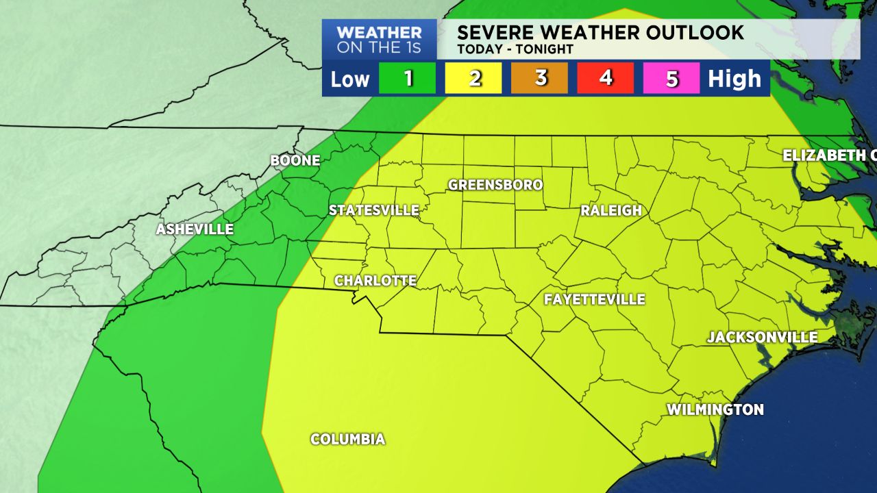
The severe threat will be highest for areas along and just to the east of the I-77 corridor this afternoon, where damaging wind will be the main threat with any of these storms that do happen to develop, though an isolated tornado cannot be ruled out.
The front will be fast moving and pull to the east of the area by Monday night before a drier, cooler air mass follows in its wake for the middle of the work week.