


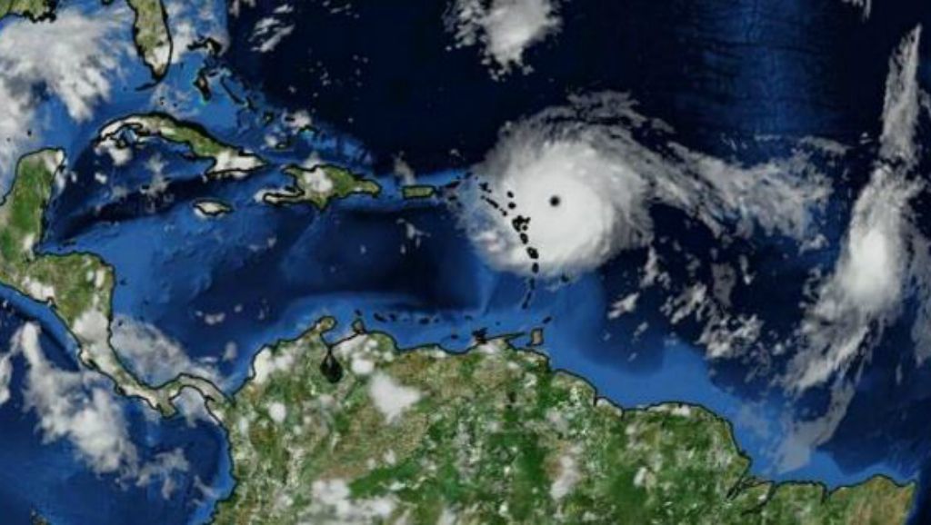
Hurricane Irma strengthened to a "potentially catastrophic" Category 5 system, while two other storms loomed elsewhere in the tropics Tuesday.
Irma had maximum sustained winds of 185 mph as of 1 p.m. CT and was about 130 miles east of Antigua. It was moving west at 15 mph.
Florida Gov. Rick Scott has declared a state of emergency, and some grocery and big-box stores were out of bottled water several days before its forecast arrival. Long lines were forming at some gas stations.
Hurricane warnings were in effect for the Leeward Islands, including the U.S. Virgin Islands, as well as Puerto Rico. Watches were in place for Guadeloupe, parts of the Dominican Republic and Haiti and the Southeastern Bahamas.
Hurricane-force winds extend about 60 miles from its center. Tropical-storm-force winds extend to about 175 miles out.
Irma will be traveling over very warm waters, which will be a favorable environment for sustaining its strength as a Category 4 or 5 hurricane, although fluctuations in intensity will continue with eyewall replacement cycles.
On the current forecast track, the center will move near or over portions of the northern Leeward Islands tonight and early Wednesday, accompanied by life-threatening wind, storm surge and flooding.
Four to 8 inches of rain are possible within the path of Irma, with localized amounts of 12 inches. Isolated areas could get up to 20 inches.
The official forecast cone includes parts of the Lesser Antilles, the Virgin Islands, Puerto Rico and portions of the Dominican Republic, Haiti, Cuba, the Turks and Caicos and the Bahamas.
After impacting the Leeward Islands and Puerto Rico, there remains some uncertainty where Irma will go, but today, there's model consistency over a more westward track and an eventual turn toward Florida. Exactly where this turn will occur, whether it is west of the peninsula, east of it, or right up the spine is yet to be determined.
There remains a large spread in the models of where this storm could be past day five, which makes a significant difference in the forecast.
Irma will likely maintain a westward track for the next 24 hours, then take on a west-northwest track as it encounters the southwest edge of a ridge of high pressure over the Central Atlantic. This ridge, along with a trough over the United States, will be the driving force for Irma late in the week and into the weekend. Where the trough and ridge position themselves as Irma gets closer to the U.S. will determine the dangerous storm's exact track.
Tropical Storm Jose forms in Atlantic
In addition, a new tropical storm formed over the Atlantic Ocean on Tuesday morning.
Jose became the Atlantic’s 10th named storm during the 2017 season. Jose had 40 mph winds and was moving west-northwest at 13 mph. Jose was located about 1,505 miles east of the Lesser Antilles. It's no immediate threat to the U.S., but it could become a hurricane by Thursday morning.
Tropical Depression 13
Tropical Depression 13 also formed Tuesday afternoon, in the Bay of Campeche in the southwestern Gulf of Mexico. It's expected to impact Mexico.
The peak of the hurricane season is Sept. 10. The 2017 Atlantic hurricane season runs through Nov. 30.