


WILMINGTON, N.C. -- A developing non-tropical (for now) area of low pressure will move quickly to the northwest Tuesday, bringing scattered showers and storms to the region. A cold front moving into North Carolina Wednesday will allow for a period of unsettled weather continue into the weekend.
- A cold from moves into North Carolina on Wednesday.
- It will stall through Thursday and possibly to the weekend.
- Scattered storms will be a daily occurence.
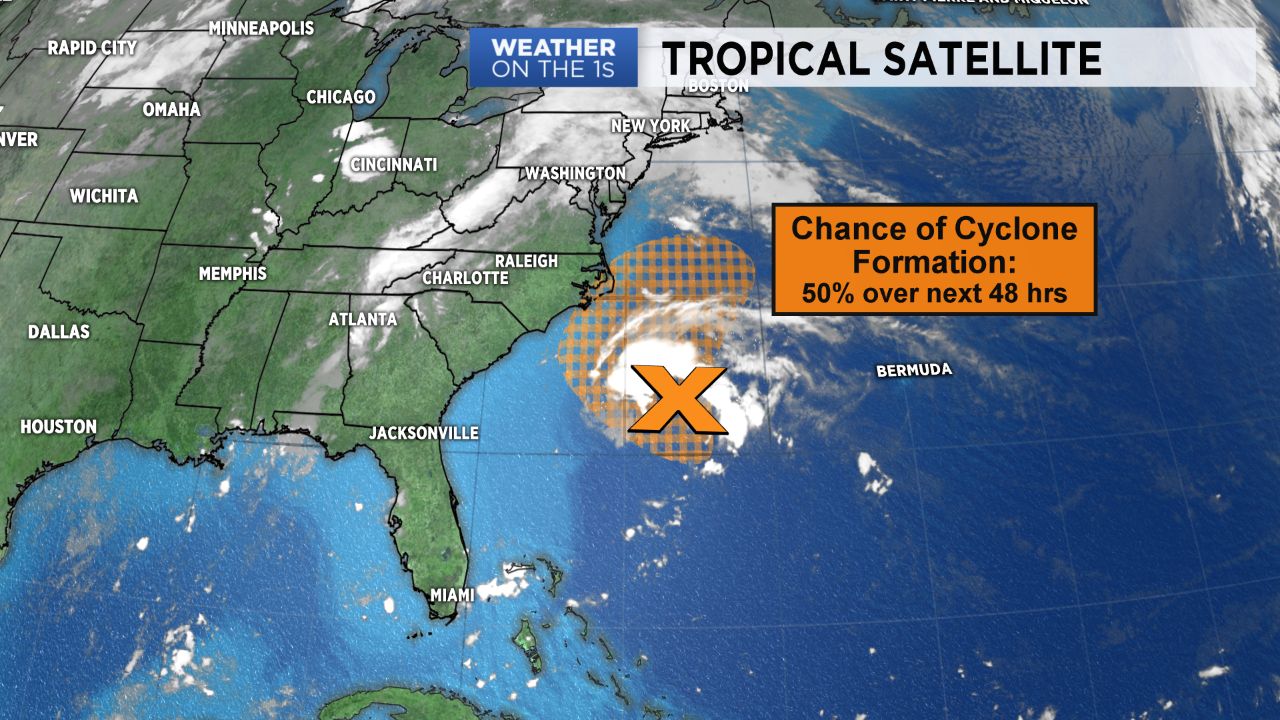
A low pressure system in the Western Atlantic that came from some left-over energy from Florence continues to move to the northeast Tuesday morning. The National Hurricane Center gave it a 50% chance of tropical development over the next 48 hrs. Regardless of development, it is set to bring in up tick in rain chances across the North Carolina coast. Expect scattered showers and maybe a few storms to move inland throughout the afternoon. Thankfully, this won't pose much of a concern to river levels as rain amounts should be fairly light, with a few hundredths to up to a half an inch possible into Wednesday morning.
By Wednesday, this system will be moving quickly offshore as a cold front approaches from the west. This front will move into the western half of the state late Wednesday and is expected to stall out through Thursday -- perhaps even into the weekend. Because of this, scattered showers and storms will be a daily occurrence at least into Saturday with some improvements possible Sunday into early next week as high pressure tries to move in.