


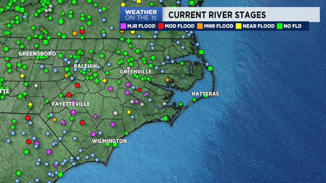
Flooding continues across much of southeastern NC. Area roads are affected and changing with each hour. Please listen to local EMA's, the highway patrol, and other emergency personnel. DO NOT drive around barricades.
The tide cycle will likely bring flooding to Wilmington as the lower Cape Fear continues to struggle with water volume. Areas prone to flooding are likely to flood over the next few cycles. We'll need to keep an eye out in downtown Wilmington and portions of River Road in Wilmington. Water Street, South of Market Street could flood. US 421 Northbound near the battleship could flood, and roads around the state port.
Temperatures are expected to remain above normal for this time of year. While a cool front will settle South, and become stationary, we don't anticipate much in the way of shower/storm development for Monday. We should see a better chance for showers/storms Tuesday and again Friday.
The low, out near Bermuda, is expected to track just off the coast. This could help enhance our rain potential by mid-week. Right now, as of this post, the window is small for this thing to develop into a TD or TS. There doesn't seem to be a lot of "high alert" chatter within the forecast community about this low.