


While we enjoy sunny and warm weather Friday and Saturday, we all should keep a close eye on a strong spring storm system moving across the central United States. Severe storms are expected from Texas to Alabama and Tennessee from Friday through Saturday. That storm system will then take aim at the Carolinas on Sunday.
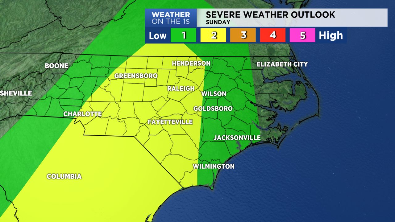
The Storm Prediction Center has already placed much of North Carolina under a marginal to slight risk for severe weather. That is the first two levels of their five level risk scale. Sunday's storm threat could increase through the weekend depending on how the weather system evolves as it approaches the Carolinas.
One thing to watch for will be our weather conditions on Sunday morning. If we stay cloudy with showers Sunday morning, the severe weather threat would be lower for Sunday afternoon. If we see breaks in the clouds with sunshine Sunday morning, the atmosphere will become more unstable providing fuel for severe storms Sunday afternoon and night.
As it appears now, scattered strong storms may break out in central North Carolina Sunday afternoon. These storms could be capable of producing isolated tornadoes and large hail.
A line of more widespread storms could then develop to our west late Sunday and move across central and eastern North Carolina through late Sunday night. That line of storms could produce torrential downpours, damaging wind gusts, and frequent lightning.
The storm threat should come to an end during the early morning hours of Monday.
Our weather team will be working through the weekend to provide you with updates on the severe weather threat. Stay tuned to Weather on the 1s on Spectrum News for the latest.
Get the latest news, sports and weather delivered straight to your inbox. Click here to sign up for email and text alerts.