


CHARLOTTE, N.C. -- A cold front has slowly pushed south of North Carolina over the past 24 hours and will bring cooler conditions for all areas of the Piedmont and High Country on Monday. Storm chances will increase by the end of the work week as a stronger cold front approaches.
- A cold front will bring cooler conditions for North Carolina.
- Storm chances will become higher toward the end of the week.
- Monday will have mainly cloudy skies.
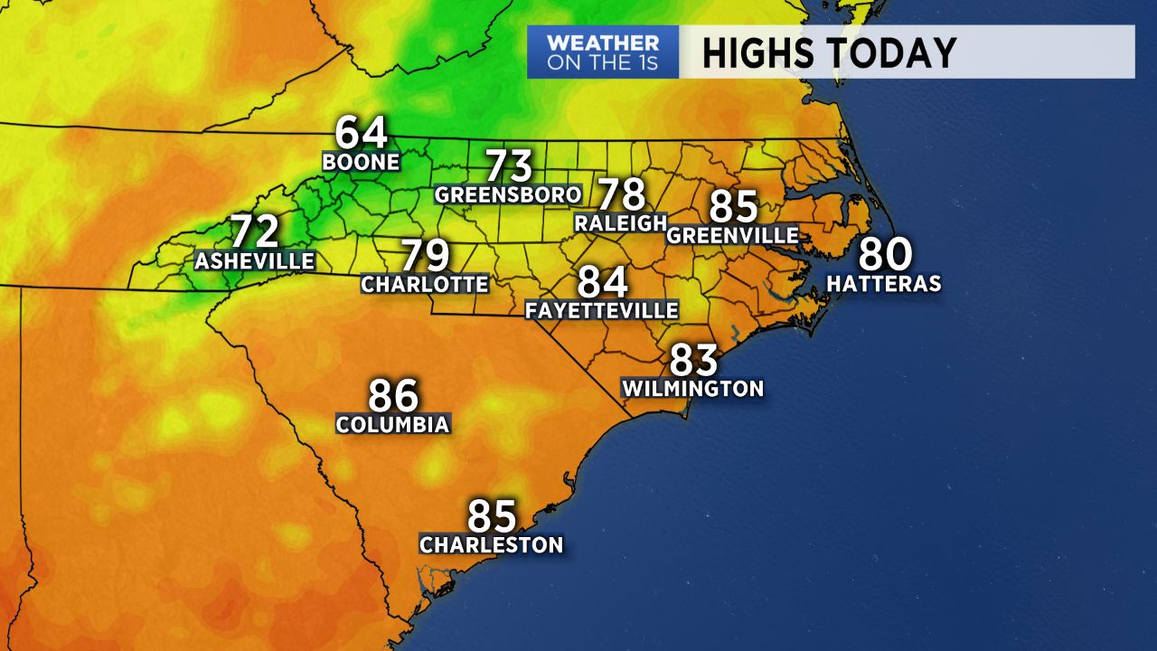
Gear up for a day of mainly cloudy skies Monday with Fall-like temperatures. High should be near average today and top off in the mid to upper 70s with 60s in the mountains. With a northeasterly flow still in place, expect the best chance for showers to be confined to the mountains, though we could see a few push into the Piedmont, especially by Monday evening.
Tuesday will bring improving conditions. Expect more sunshine as the "wedge" begins to break down and a rebound in temperatures.
By Wednesday a strong cold front will begin pushing across the Blue Ridge, allowing for an increase in storm chances. The front is set to stall out across the area through the end of the work week, allowing for storms each day through at least Friday. Behind the front cool, dry high pressure will build in across the region, allowing for Fall-like temperatures to resume.
Get the latest news, sports and weather delivered straight to your inbox. Click here to sign up for email and text alerts.