


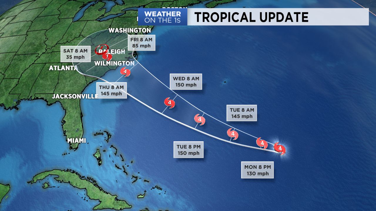
CHARLOTTE, N.C. -- Florence will continue to undergo a period of rapid intensification Monday as it moves over warm waters in a low wind shear environment. While the exact track of Florence remains uncertain, the threat of a North Carolina landfall sometime Thursday into Friday continues to increase.
- A cold front that sagged southward Sunday will lift northward again as a warm front Monday, bringing additional rounds of scattered showers and storms.
- Highs will be in the mid to upper 80s. This unsettled weather pattern will continue for the next few days.
- As of 12 p.m. on Monday, Florence is currently a Category 4 hurricane.
Before we dive into Florence, let's get to today's weather. A cold front that sagged southward Sunday will lift northward again as a warm front Monday, bringing additional rounds of scattered showers and storms by the afternoon.
A few isolated severe storms will be possible. Highs will be in the mid to upper 80s. This unsettled weather pattern will continue for the next few days as a cold front moves in from the west with Florence approaching the East Coast by Thursday.
As of 12 p.m. on Monday, Florence is now a Category 4 hurricane. Landfall somewhere along the Carolinas has now become more likely, where the threat for life-threating storm surge and inland flooding has increased.
However, the exact track, particularly as it works its way inland, remains uncertain. Due to this, exact impacts and magnitudes of those impacts are still up in the air. For now, North Carolinians need to be getting their hurricane preparations at the ready. Stay tuned!
Get the latest news, sports and weather delivered straight to your inbox. Click here to sign up for email and text alerts.