


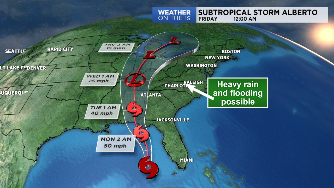
NORTH CAROLINA -- Plenty of tropical moisture will begin spreading into the Tar Heel State beginning late Sunday night as Alberto pushes towards the Gulf Coast states, likely to make landfall late Monday.
- Heavy rain and flooding will become a concern over the coming days
- Sunday will feature another humid, relatively quiet day with small chances for scattered showers and storms
- Showers will begin spreading in from south to north late Sunday night into Monday
Heavy rain and flooding will become a concern across the state over the coming days as Alberto's remnants move northward.
Sunday will feature another humid, relatively quiet day with small chances for scattered showers and storms. A disturbance passing through the North Carolina mountains Sunday afternoon will bring a scattered chance for showers and storms for the High Country, foothill counties, and areas closest to the Virginia border. Elsewhere, for the Piedmont and most of the Triad, expect partly sunny skies and muggy conditions with highs in the low to mid 80s.
Showers will begin spreading in from south to north late Sunday night into Monday. Memorial Day will kick off to a wet, rainy start for some, but shouldn't be a complete "wash-out" of a day as periods of dry time will be mixed in with periods of rain. Localized heavy rain will be possible under any storms that happen to develop, which will remain the major threat rather than severe weather.
In fact, because soils are already quite saturated across the region -- particularly in the mountains -- Flash Food Watches will go into effect Sunday evening into early Tuesday. Rainfall totals over the next few days will range from 1"-3", with the potential to pick up between 3"- 6" in some areas locally.
Periods of heavy rain will continue into Tuesday and Wednesday as what's left of Alberto moves northward through the Tennessee and Ohio River valleys. Some severe storms may be possible Tuesday, with Alberto's remnants making the closest approach from the west at that time.