


Snow is likely for much of our region Wednesday morning.
Roads will likely develop some slick spots and travel could be a problem for much of the day through early afternoon, especially for metropolitan areas.
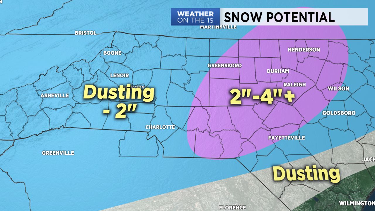
1-2" are possible for most areas with, perhaps 3"+ south and east of the I-85 zone.
Southeast Rowan, Cabarrus, Stanly, Anson and Richmond Counties appear to be in a better position for heavier snow, if heavier banding materializes.
Temperatures likely will not get above freezing for Wednesday, but clearing skies and some sunshine will be seen later in the afternoon.
What is liquid will turn to black ice Wednesday night and early Thursday morning. So please use caution on area roads.
Temperatures are forecast for the mid 40s Thursday, so any snow that lingers will likely be gone.