


Evidence of an emerging El Niño is leading forecasters to predict a less active hurricane season in the Atlantic this year. But that doesn't mean that the risk of a tropical cyclone impacting the U.S. is non-existent.
The turn of the decade brought a steep uptick in the number of named storms and hurricanes, especially in 2020 and 2021.
Despite the late start, the 2022 season still became an average season for the number of named storms. We saw 14 storms, eight of which became a hurricane.
Prior to the start of the season, Colorado State University (CSU) and the National Oceanic and Atmospheric Administration (NOAA) released their outlooks for the Atlantic basin this year.
Both predictions agreed on one thing: Less tropical activity is expected in the Atlantic basin this season–at least compared to the extra-busy seasons before last year, anyway.
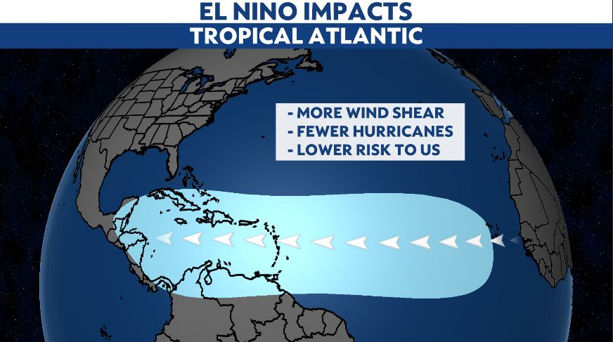
While there are many factors to consider, the El Niño-Southern Oscillation (ENSO) plays a key role in determining how active the tropics will be.
Strong La Niña conditions accounted for the above-average activity in 2020 and 2021, but a shift from ENSO-neutral conditions to an El Niño pattern over the summer is expected to become more prominent by the end of the year.
This isn’t a surprise by any means. After all, a below-average Atlantic hurricane season is a side effect of an emerging El Niño.
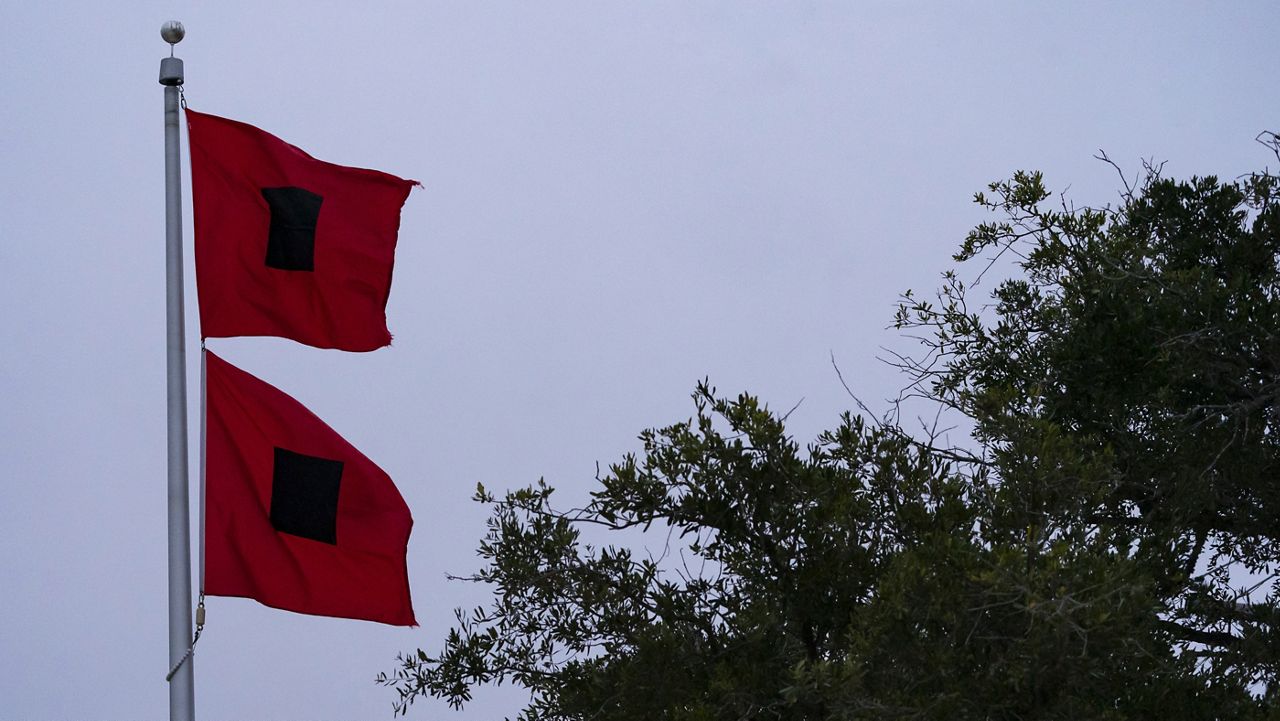
Regardless of whether or not it’s an active season, we must never become complacent that we’re out of harm’s way. A quieter season doesn’t always translate to a less impactful one.
In their 2023 outlook, CSU used its forecast, along with NOAA's historical storm tracks, to predict the odds of a tropical cyclone landfall (or close pass) for each of the states.
Their calculations revealed that multiple states face over a 50% chance of having a named system make landfall this season. Unsurprisingly, most of these states are in the Southeast or along the Gulf of Mexico, with Florida seeing the highest probability of 87%.
The 1983 hurricane season serves as an excellent reminder that dangerous storms can still form, even during the "less active" El Niño years.
Only four named storms formed in the Atlantic basin that year, making it the least active hurricane season in the satellite era. However, three still made landfall on U.S. soil- and the first was the worst.
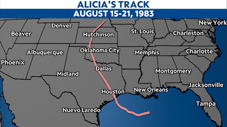
On Aug. 15, Alicia formed in the Gulf of Mexico, and steadily intensified as it tracked west. It became a major Category 3 hurricane on Aug. 18, just prior to making landfall on the Texas coastline about 25 miles southwest of Galveston.
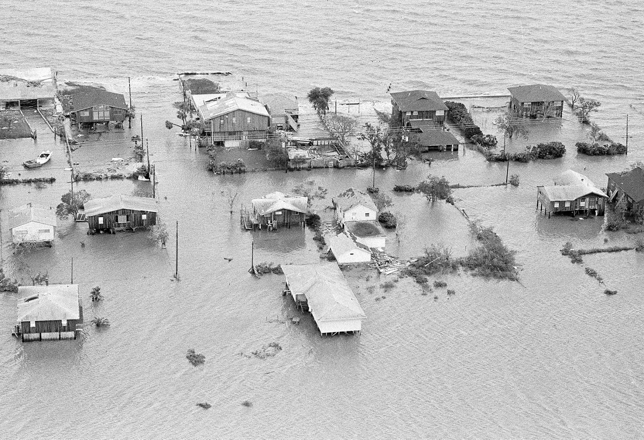
Powerful winds and storm surge generated by Alicia lead to nearly $2 billion worth of damage, making it the costliest storm to hit Texas at that time. But even worse, the hurricane took the lives of 21 individuals.
While not as damaging as Alicia, the other two named storms that made landfall in the U.S., Barry and Dean, still brought additional hazards and costs to the areas they impacted.
)
The number of named storms this season may not reach the record-breaking numbers from a few years ago, or even become an above-average season. But it only takes one powerful storm to bring significant impacts to a region.
Our team of meteorologists dives deep into the science of weather and breaks down timely weather data and information. To view more weather and climate stories, check out our weather blogs section.