This spring has been anything but average for the St. Louis region. It seems like we can’t go more than a few days without some type of severe weather warning.
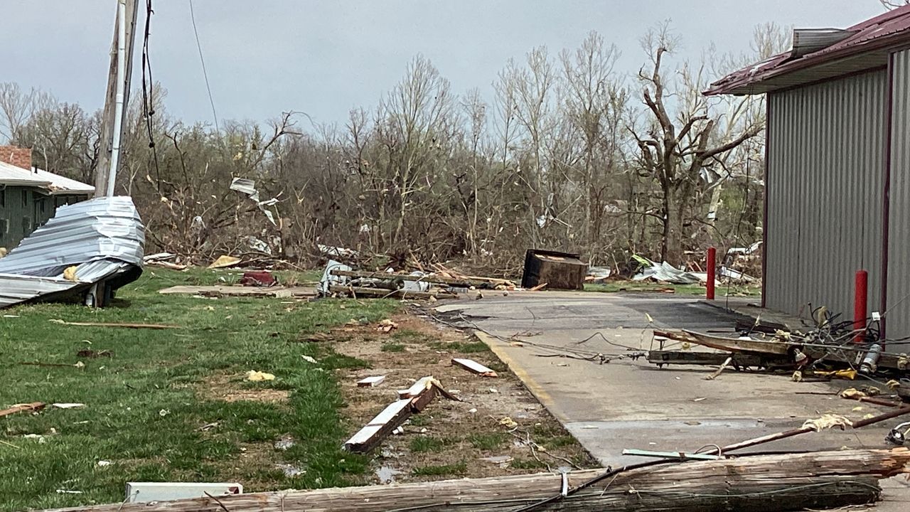
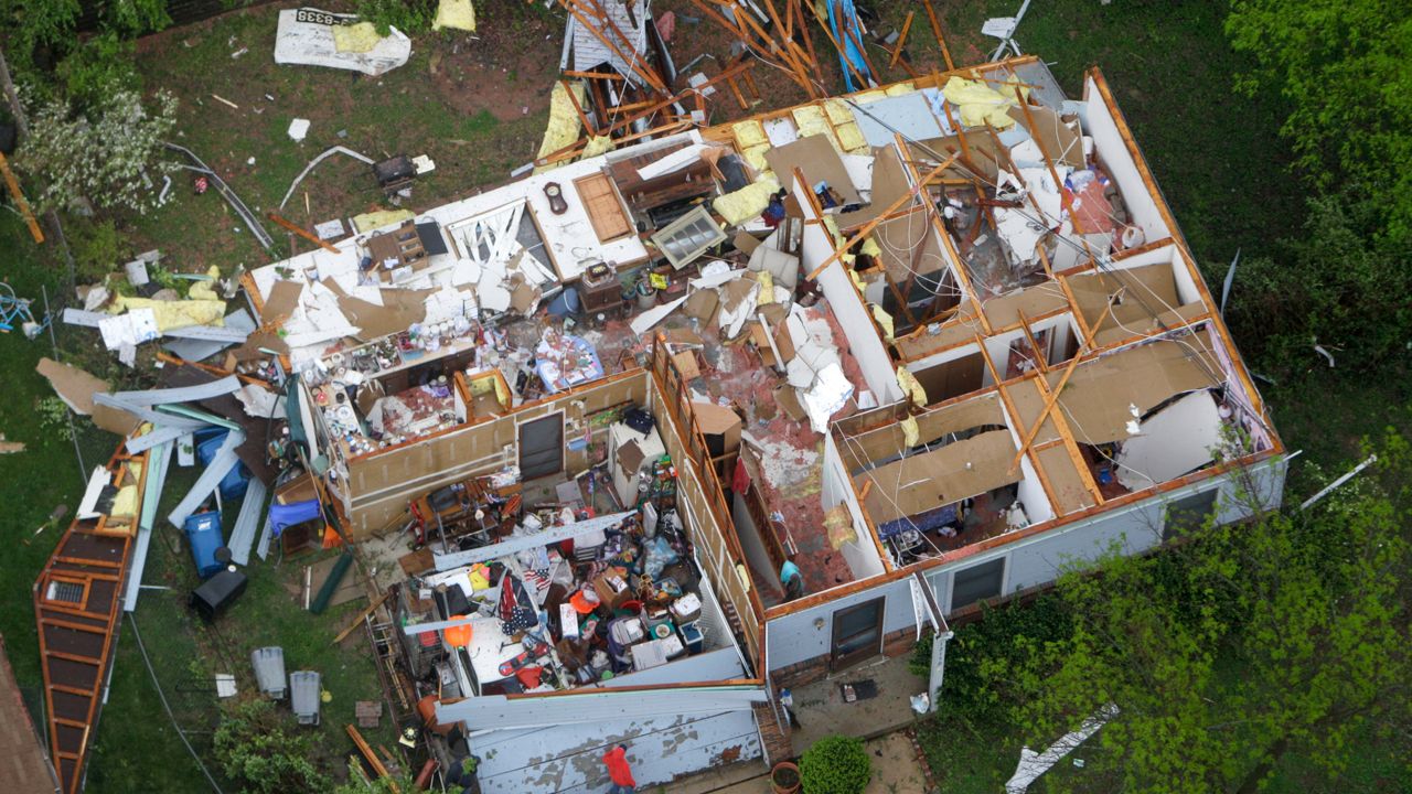
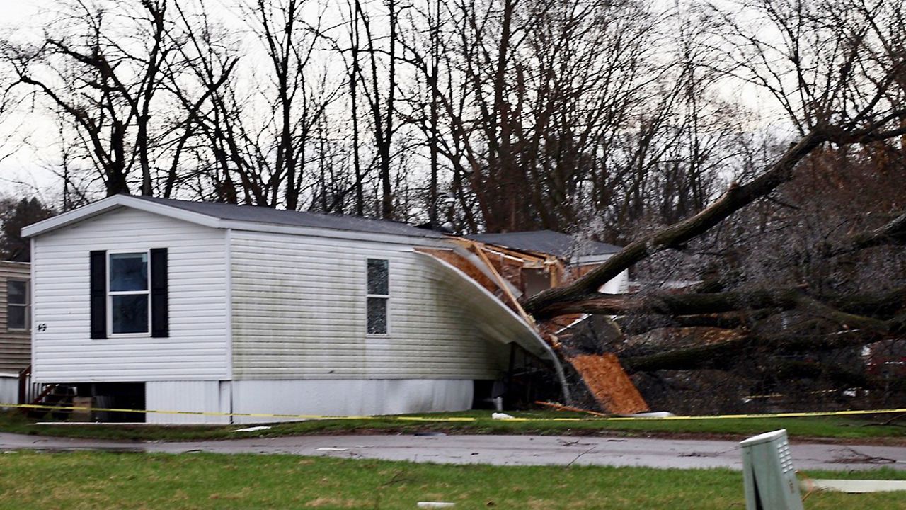
Severe storms have caused widespread damage from tornadoes, large hail, strong winds and even flash flooding.
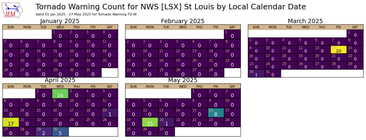
Missouri leads the country with the highest number of tornado warnings through May 26, 2025, with 221 warnings. The forecasting area includes the 46 counties the National Weather Service in St. Louis has responsibility for and spans across east central Missouri and west central Illinois. In this area, Washington County, Mo. has seen the most tornado warnings, with 18 so far this year.
Through May 26, 2025, the confirmed tornado count is up to 40 confirmed across this specific region. This is an increase through the same period over the past six years.
Between 2019 and 2022, fewer than 11 tornadoes occurred during the first five months of each year. In 2023 there were 14 recorded tornadoes, with last year seeing an active year counting 38 tornadoes, as May was quite busy.
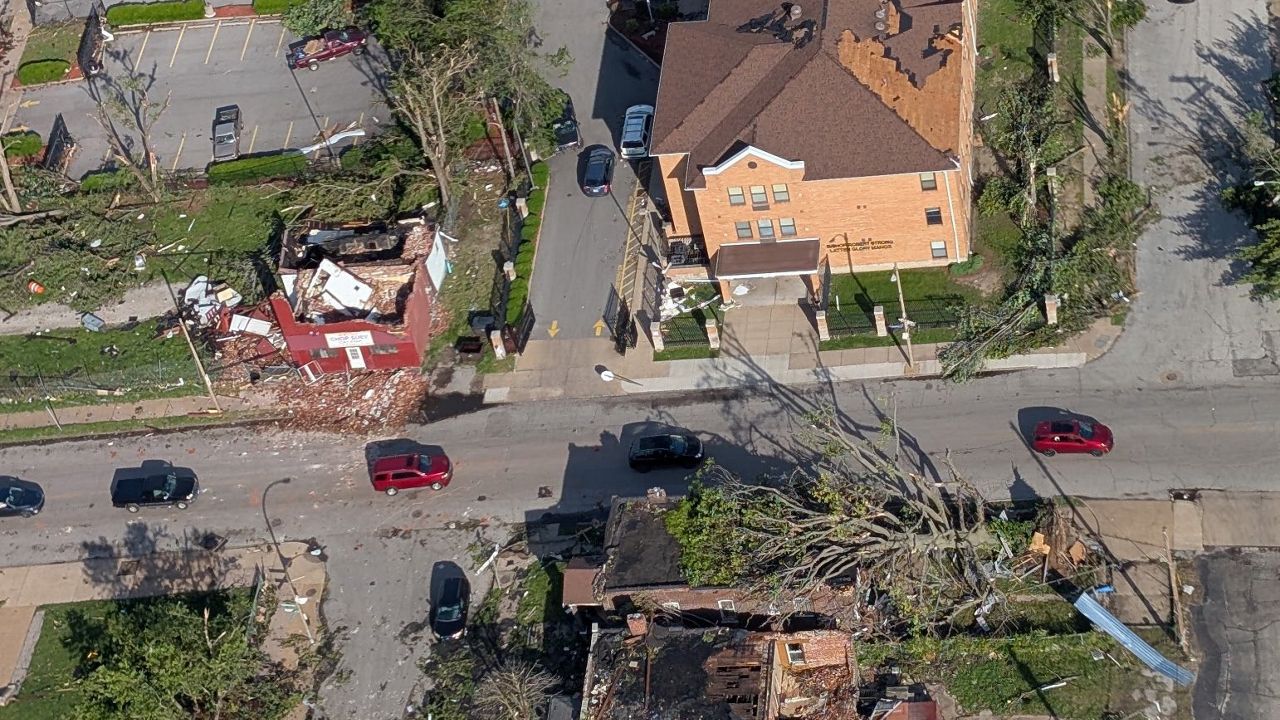
Notable days in the St. Louis metro area were March 14, where an EF2 tornado touched down near Villa Ridge, Mo. and tracked for just over 30 miles through western and northern St. Louis County and then eastward across the Mississippi River into Illinois.
It finally lifted back into the clouds just north of Alton, Il. Widespread damage was noted along this path, with Bridgeton, Mo. as one of the hardest hit regions.
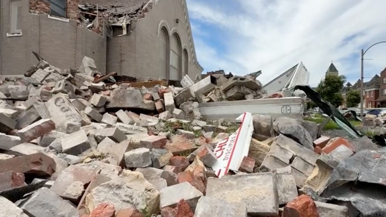
More recently was May 16, when a powerful EF3 tornado with estimated winds of 152 mph touched down near Clayton, Mo. and tracked nearly 23 miles through North St. Louis City before finally lifting back into the clouds across the river near Edwardsville, Ill.
Storm fatigue is real, but don’t let you guard down this summer.
While not every warning produced a tornado, there was the potential for a tornado from every warned storm.
“There have been many warnings issued this year, and many places have not seen a tornado, but we take great pride in not over warning our communities,” says Warning Coordination Meteorologist Kevin Deitsch, with the National Weather Service in St. Louis.
Emphasizing, “We only put out Tornado Warnings when we believe there is a likelihood of a tornado touching down, so it’s important to take all warnings very seriously!”
A tornado can occur any month out of the year. We’ve seen that happen with Dec. 10, 2021 tornadoes in Defiance, Mo. and Edwardsville, Ill. and the “Good Friday” April 22, 2011 tornadoes that hit St. Louis County, including Lambert Airport.
With so many severe weather events and prolonged events, various people are experiencing storm fatigue. However, with the high likelihood of severe weather in the St. Louis region, it’s best not to let your guard down.
Folks at NWS are staying true to the mission. “This is our mission we are so dearly passionate about and are always eager to serve the American public, so while these events are exhausting, we know we are helping to keep people safe through these events,” says Deitsch.
Tornado counts usually peak from March to June and then taper into the summer. The reason is because of the jet stream. Thunderstorms that produce tornadoes need wind shear and strong wind shear is provided by the jet stream.
During the summer, the jet stream shifts north, toward the U.S.-Canadian border, thus reducing the amount of wind shear and limiting the chances for thunderstorms to produce tornadoes. We may see more thunderstorms during the summer, but without wind shear, storms that become severe are more likely to produce hail and damaging winds.
Download the Spectrum News App for the latest forecast updates.
Our team of meteorologists dives deep into the science of weather and breaks down timely weather data and information. To view more weather and climate stories, check out our weather blogs section.
)