


Clouds will increase overnight as high pressure departs. After initially falling into the low to mid teens, look for temperatures to rise after midnight.
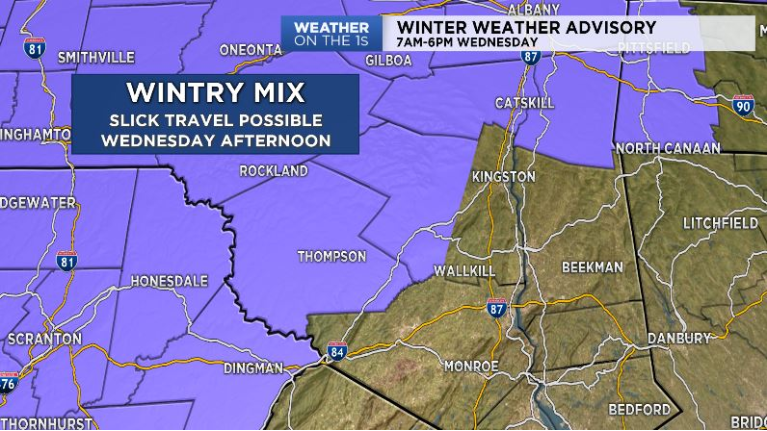
Light snow will break out by the mid to late morning to the west. Most areas will be cold enough for precipitation to begin as a mix of snow, sleet and potentially freezing rain given how cold the ground is right now. Some slick travel can be expected Wednesday afternoon across the Catskills.
Temperatures will continue to rise into Wednesday night effectively flipping precipitation to rain for all.
Thursday will feature steady rain during the morning with precipitation possibly ending as a burst of wet snow during the afternoon.
Temperatures look to go back below average for the end of the week with highs in the 20s Friday and Saturday.