


Quantity is key for nailing down the weather forecast. The more observations, the better.
New York State is one of the best prepared in the nation to deliver the most accurate and precise forecasts to its communities, thanks to the New York State Mesonet (NYSM).
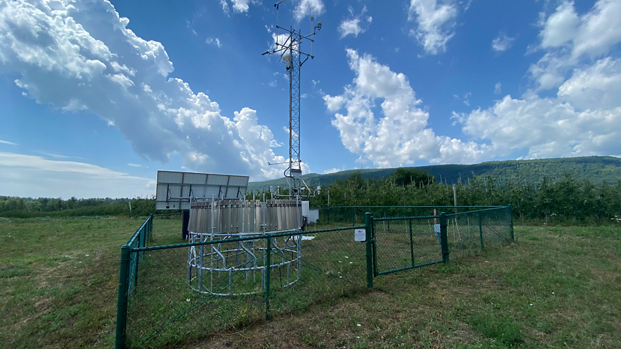
Located on rooftops, school grounds, parks and orchards, the NYSM is a dense network of weather stations. The standard network consists of approximately 126 stations throughout the state spaced out roughly 19 miles apart, with at least one in every county.
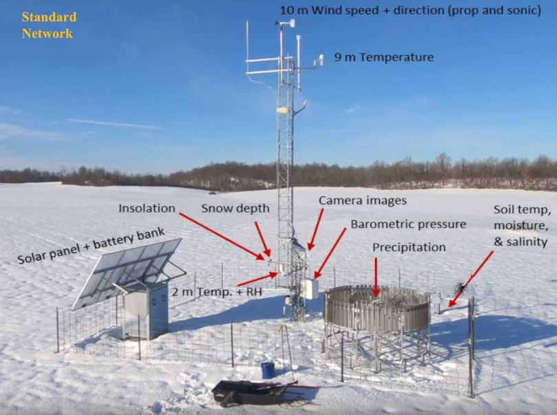
Equipped with an advanced set of tools, each one measures and collects up-to-date observations regarding temperature, precipitation, wind and more.
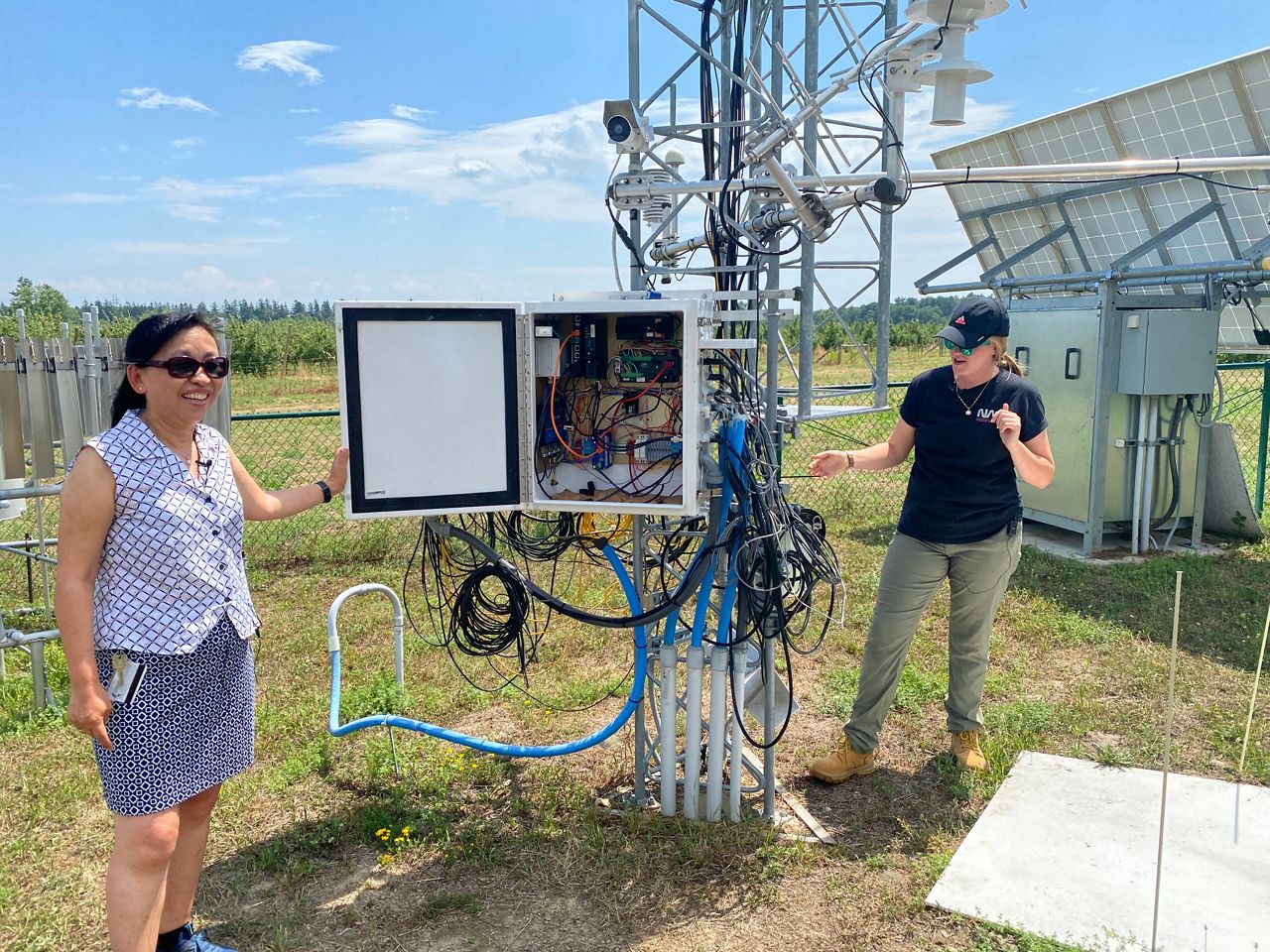
These observations are then quality controlled and archived by staff before becoming accessible for public viewing in real time.
The idea to invest in such a network began in 2011 following Hurricane Irene and Tropical Storm Lee. Yet, just a little more than a year later, Super Storm Sandy devastated parts of the state, which further escalated the project and prompted a decision to be made.
Given that the state is one of the most economically vulnerable to weather, the New York government agreed to take on the $30 million project in collaboration with the Department of Homeland Security and Emergency Services.
With the University at Albany helping to design, install and operate the system, the NYSM was completed in 2018.
Many other states have invested in mesonet stations over the years as well, but the NYSM is special because it is the country’s most advanced network.
One feature that sets it apart from the rest: it is the only network to have cameras.
Initially installed for security, meteorologists discovered the cameras offered an even bigger bonus, allowing them to see what's actually going on outside.
While radar is an essential tool in monitoring precipitation, it unfortunately comes with some disadvantages. Its limited range often leaves gaps in coverage.
Because of the curvature of the earth, places far from the radar site do not receive a complete scan of the atmosphere. As a result, radar may show that it is raining in some places, when in reality, it is not.
While light precipitation can sometimes become difficult to spot, the cameras can reveal whether rain, sleet or snow is actually reaching the surface, especially for places that are far from a radar.
Time-lapse footage taken from the cameras even documented some of the most intriguing events, from quickly accumulating snowfall to developing thunderstorms and even flooding.
In addition, the cameras are also great at verifying whether fog is affecting an area, something else that radar cannot detect.
The cameras also captured many other desired shots over the years, ranging from funnel clouds to vivid rainbows, and even wildlife making a debut from time to time.
Meteorologists in media are the ones who get the word out to their communities and viewers whenever a severe weather watch or warning is issued, but they aren’t the ones who make that decision. Only the National Weather Service (NWS) meteorologists make that call, one that can prove difficult at times.
A bulk of the state’s population lives in the New York City metro area, but there are plenty of open land areas upstate that remain unoccupied. With limited observational feedback in those less populated areas, forecasting under intense and urgent situations becomes a challenge.
Christina Speciale, meteorologist at the NWS office in Albany, recalls one specific event where the Mesonet data came to the rescue: the 2020 derecho. The potent line of storms brought powerful wind gusts that exceeded 75 mph in places, impacting the region with numerous downed trees and power outages.
“The mesonet data was so helpful for the derecho because it gave us ground truth measurements that the incoming storms were producing severe wind gusts,” Speciale explained.
After seeing one mesonet site report gusts over 50 mph, the meteorologists on staff adjusted wind gust speeds within the warning area to over 70 mph.
According to Speciale, “When multiple mesonet sites in the Mohawk Valley gusted over 50 mph, we knew the storms were very strong and that gave us the confidence to make our warning larger.”
By doing this, the NWS could inform nearby communities well in advance of what to expected and what necessary actions to take before the storms arrived.
The best part: Data and footage provided by each of the mesonet sites isn’t just for the eyes of the NWS and media meteorologists. The public can also use and access its information by visiting the NYSM website.
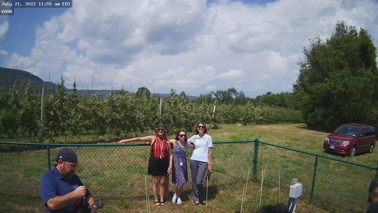
Those heading to Indian Ladder Farms to go apple picking in the upcoming weeks can pay the Voorheesville NYSM station a visit. If you’re standing in the right spot, you might even get caught on camera.
Our team of meteorologists dives deep into the science of weather and breaks down timely weather data and information. To view more weather and climate stories, check out our weather blogs section.