


Have you ever looked out your window on a snowy day and wondered how that snowflake formed? Maybe you want to know how we get graupel or freezing rain.
Let's break down the science and talk about how different precipitation types form.
The temperature in the atmosphere determines what type of precipitation we get at the surface.
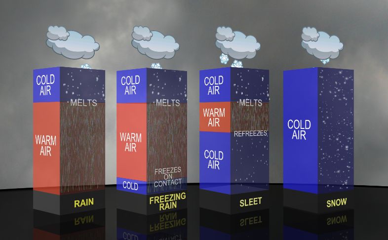
In the upper atmosphere, the temperature is cold, and precipitation often starts as snow. It is the warm air that mixes in at different layers of the atmosphere that gives us different types of precipitation.
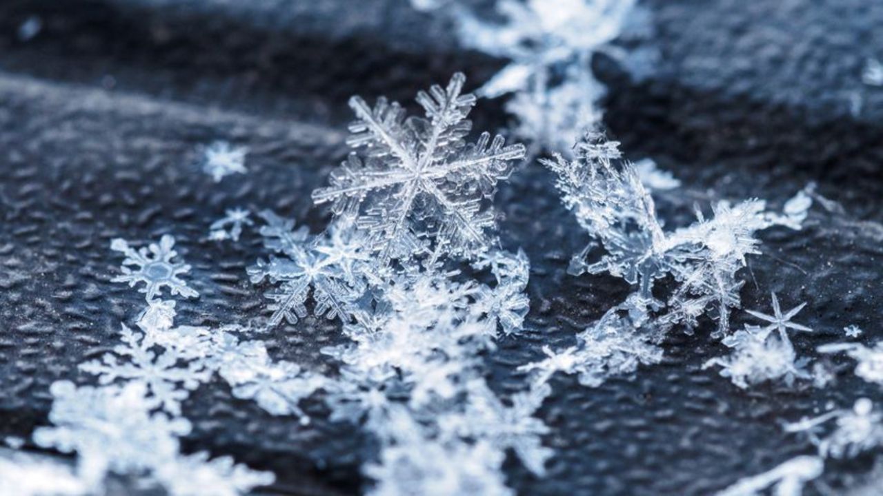
In the diagram above, you'll notice that the temperature does not change throughout the atmosphere for snow. As long as we have temperatures at or below 32 degrees Fahrenheit, we'll get snow.
If those ice crystals collect to each other as they fall towards the surface, you get a beautiful snowflake.
Snowflakes that fall through dry, cold air will form "powdery" snow.
If the air temperature is between 32-35 degrees Fahrenheit, the ice crystals will partially melt and stick to each other. This creates bigger and heavier snowflakes. This snow is perfect for snowball fights and building snowmen.
Has it ever snowed in your area, but the snow fell in the form of soft, tiny balls? Well, you might've experienced graupel.
According to NOAA, graupel is soft and small pellets that form when supercooled water droplets, at a temperature below 32 degrees Fahrenheit, freeze onto a snow crystal. This process is called riming.
Graupel tends to melt or disintegrate when you touch it.
Freezing rain will occur when precipitation enters a deep warm layer in the atmosphere then moves into a shallow layer of below-freezing air at the surface.
The precipitation begins as either rain or snow but becomes rain in the warm layer. The rain falls back into the air that is below freezing but does not have enough time to re-freeze since the depth of the cold air is shallow.
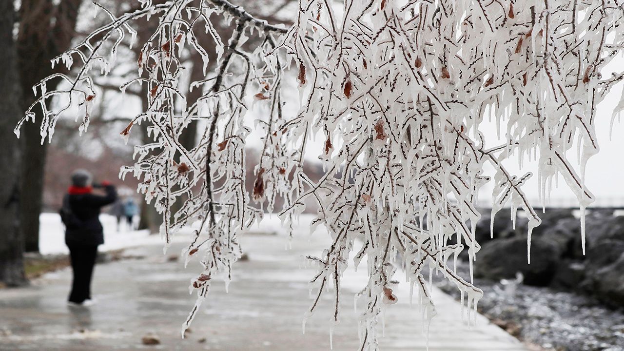
The rain freezes on contact when it hits the ground, bridge, or vehicle.
Freezing rain is the cause of ice storms. The accumulation of ice on the surface and tree branches can lead to massive power outages, automobile accidents, and injuries when walking on slippery surfaces.
When snow falls into a shallow layer of warm air, the snow partially melt. It then moves into a layer of below-freezing air and freezes back into ice pellets, giving us sleet.
It can also cause slippery conditions on roadways and sidewalks.
Remember that any winter precipitation can cause slippery road and sidewalk conditions. Always be careful while driving or walking around, and slow down.
In the case of a big snow or ice event, be prepared before the storm hits. Have extra blankets, water, flashlights, and batteries handy.
Our team of meteorologists dives deep into the science of weather and breaks down timely weather data and information. To view more weather and climate stories, check out our weather blogs section.