


WEATHER HEADLINES:
→ Few Showers/Storms This Evening
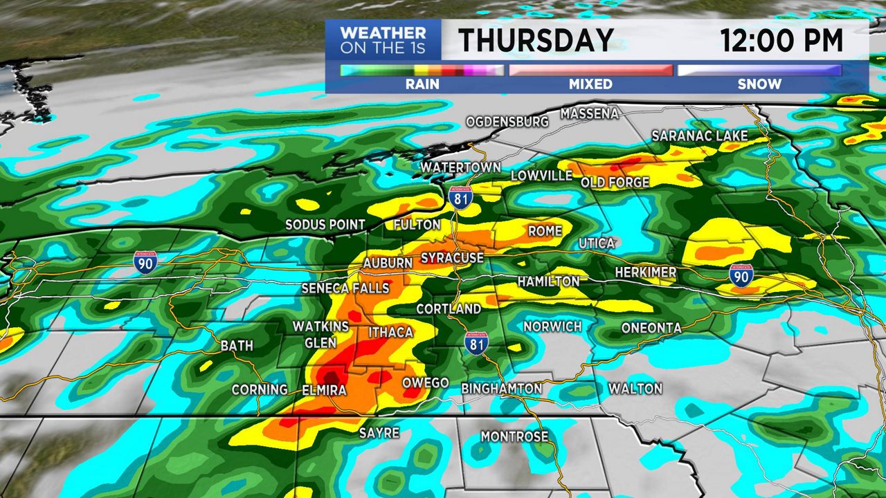
→ Rain, Heavy at Times Thursday
→ Drying Out Friday
Expect a few evening spotty showers and storms to give way to more dry time overnight. The best chance for precipitation will be from the Thruway south. Some locally heavy rain is possible within this shower/storm activity.
Track showers anytime with our Interactive Radar!
Lows Tonight:
- Central New York: 58 – 64
- Northern New York: 50s/60
- Southern Tier: 61 – 66
On Thursday, expect a relatively dry and quiet start to give way to widespread rain from late-morning through mid-afternoon. The rain will fall moderate to heavy at times. We have the potential for pooling and ponding of water on area roadways, as well as some localized flash flooding. Remember, if you encounter a flooded roadway, turn around and find an alternate route.
Latest Weather Alerts: Central New York | Northern New York | Southern Tier
The heaviest of the rain will taper by evening, and just a few leftover scattered showers are likely Thursday night.
Highs Thursday:
- Central New York: 68 – 74
- Northern New York: 60s/70
- Southern Tier: 72 – 77
Outside of a lingering shower early on Friday, we will gradually welcome in more dry time and a good deal of sunshine for the afternoon. Highs will be in the 60s to around 70.
The upcoming weekend forecast is looking fantastic for those of you with outdoor plans! We can expect mostly sunny skies for both weekend days. Highs for most locations will be in the 70s.
More rain will return early next week.
Stay tuned to Spectrum News for updates.