


Skies are generally clear through the overnight across the North Country, with clouds increasing for Central New York. Mostly cloudy across the Southern Tier. A cold and brisk night leads us into Wednesday.
Overnight Lows:
- Central New York: -/+0s
- North Country: -/+0s with some spots 10 or more below 0
- Southern Tier: 10 - 15
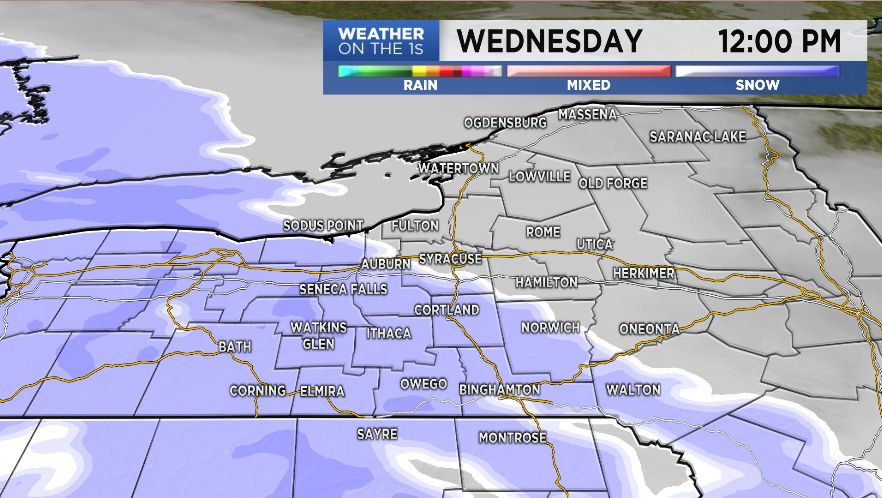
Wednesday morning is cloudy and cold, but dry. Area wide snow builds in from southwest to northeast, with snow starting to fall late morning across the Southern Tier and the Finger Lakes. Central New York and the North Country stay dry through around noon. Through the afternoon, snow spreads across the whole region, making for snow covered roads and slower travel.
Wednesday’s Highs:
- Central New York: 17 - 22
- North Country: 12 - 17
- Southern Tier: 22 - 27
By the end of Wednesday, snow should start to taper off. Accumulations aren’t major, but enough to plow and shovel.
Snow accumulations:
7-Day Forecast: Central New York - North Country - Southern Tier