


WEATHER HEADLINES:
→ Blustery with Lake Effect Snow for Sunday
→ Staying Cold for Martin Luther King Jr. Day
→ Gradual Warm-Up after Tuesday
*A winter weather advisory is in effect through 1 am on Sunday for southern Erie, Chautauqua, Cattaraugus, and Wyoming counties.*
*A winter weather advisory is in effect through 9 am on Sunday for northern Erie, Niagara, Orleans, and Genesee counties.*
*A winter weather advisory is in effect through 10 pm tonight for Allegany county.*
*A lake effect snow warning will be in effect from 1 am Sunday through 4 am Monday for southern Erie, Chautauqua, Cattaraugus, and Wyoming counties.*
*A lakeshore flood warning is in effect through 10 am on Sunday for Erie and Chautauqua counties.*
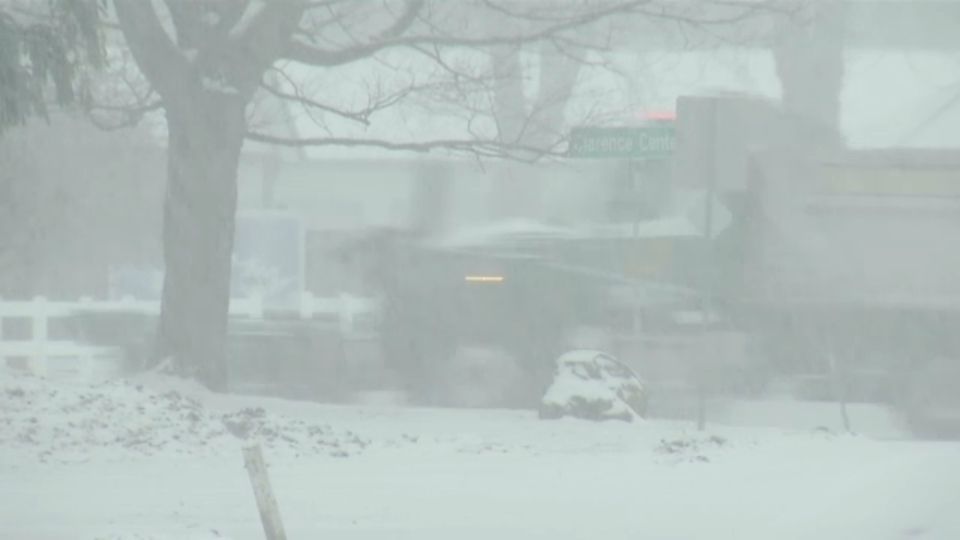
A complex storm system brought widespread snow, and even some rain and a wintry mix of freezing rain/sleet to Western New York on Saturday.
The warmer temperatures that allowed the changeover to rain and a wintry mix won’t stay. By midnight, temperatures will tumble enough for a transition back over to snow.
Lake effect snow will really start to develop overnight into Sunday morning, with a band of snow expected to graze areas, like Buffalo, overnight.
By daybreak though, winds will start to shift to be more out of the west, directing any lake effect snow across the typical snow belts of Western New York, such as Ski Country and the Chautauqua Ridge.
Track rain and snow anytime with our interactive radar!
Winds will be strong overnight into Sunday morning, as well. Gusts over 40-45 mph will be possible leading up to daybreak, before that wind slowly settles down as the afternoon progresses.
Even so, those high winds will lead to lowered visibility and blowing snow, but could also result in some minor lakeshore flooding as it helps water levels at the northeast end of Lake Erie to quickly rise. Be mindful of that for more flood prone areas along Lake Erie, such as Canalside, the Buffalo and Dunkirk Harbors, and even in low lying locations along the upper Niagara River. Spraying water will also be possible across Route 5 in Hamburg.
That wind will make it feel even colder out there for Sunday. After sunrise, temperatures will be in the upper teens and 20s throughout Sunday, but wind chills will drop down into the single digits and teens.
Not only do you have to deal with an extra cold bite to the air for Sunday, but the lake effect machine will still be kicking, as well. More scattered and numerous lake effect snow showers are expected to develop late morning into the afternoon. The lake effect activity will fizzle out some after sunset, but a few lingering flurries and light, unorganized snow showers will still be possible Sunday night into Monday.
By the time the weekend comes to an end, the highest snowfall totals are expected across the higher terrain south of Buffalo, where around a foot of snow will be possible. The lower terrain closer to the typical lake effect snowbelts can expect closer to 5-9” of snow, with 3-7” elsewhere.
Those totals include the snow that accumulated on Saturday. Keep in mind though, some of that initial snowfall will melt in the spots that saw the transition over to rain and a wintry mix for a time.
The last of the lingering lake effect will wrap up early on Monday, with some breaks of sunshine emerging as the day progresses. Even so, Martin Luther King Jr. Day will be cold with highs just in the 20s, but it won’t be nearly as breezy as Sunday.
A mix of sun and clouds is on tap for Tuesday with high temperatures still trapped in the 20s. Past Tuesday, temperatures will gradually warm up with temperatures maxing out right around 40° for Thursday and Friday. The weather will be pretty quiet as well, before another chance of a rain/snow mix moves in late Friday into Saturday.
Stay tuned to Weather on the 1s on Spectrum News for more updates!
Make sure to follow Meteorologist Christina Reis over on Facebook, Instagram, and Twitter!
RELATED: