


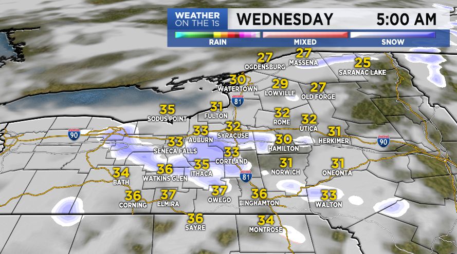
Tuesday night will feature a few rain/snow showers as temperatures drop into the 20s and 30s in the wake of a cold front. Little to no snow accumulation is expected.
A leftover snow/rain shower is possible on Wednesday and we'll be watching for clouds to give way to more breaks of sun.
Unfortunately, no amount of sun will help out our temperatures with below average highs as chilly as the 30s and 40s. This will be paired with a brisk breeze as well.
Dry conditions look to prevail on Thursday with highs in the 40s and low 50s.
Another warm up will take place Friday with temperatures climbing into the upper 50s and low 60s. There will certainly be enough opportunity to get out and enjoy the milder weather but we'll be watching for scattered showers to develop through the afternoon.
We should be able to dry things out for Saturday. Although, cooler highs in the 50s and 40s are in the forecast this weekend.