


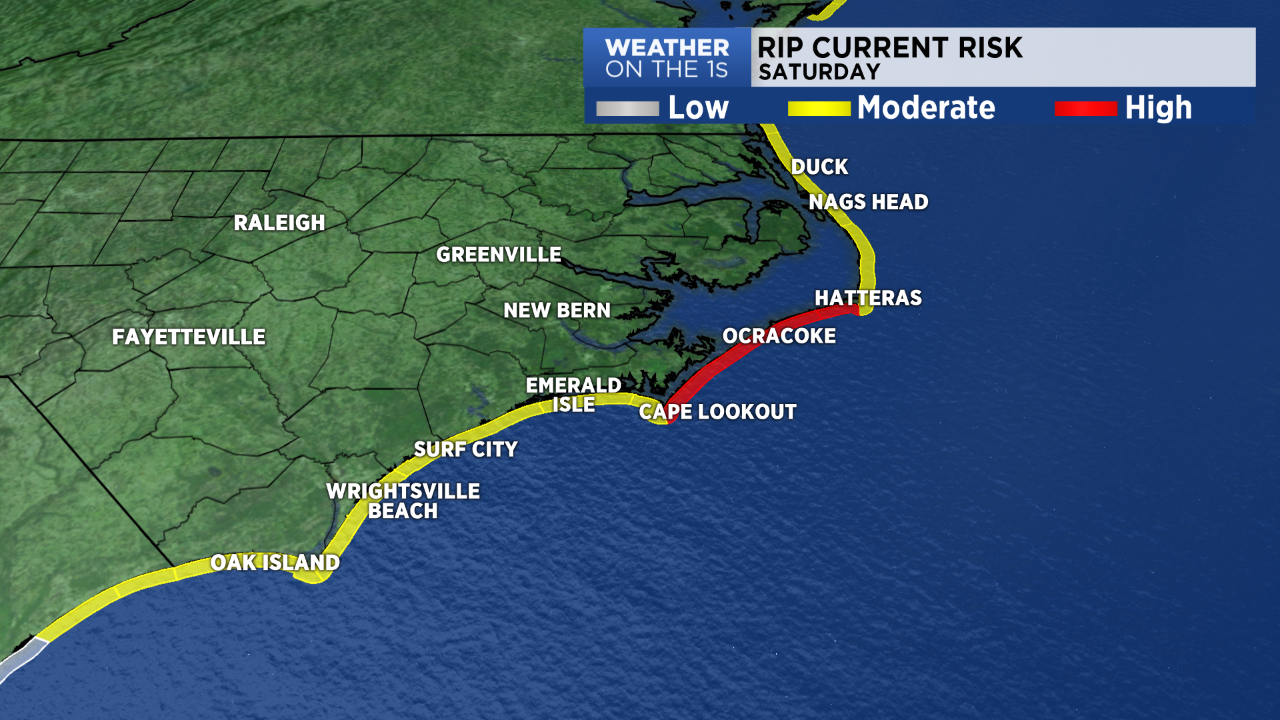
NORTH CAROLINA — More issues with rip currents along the North Carolina coast on Saturday.
A moderate to high risk for rip currents will continue on Saturday along the entire North Carolina coast as Tropical Storm Fay tracks into the northeastern United States.
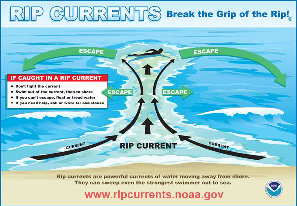
Rip currents are powerful channels of water that can pull even experienced swimmers away from shore.
If you become caught in a rip current, lifeguards recommend swimming parallel to the shore to break free from the current. Once free from the rip current, swim back toward the coast and an angle.
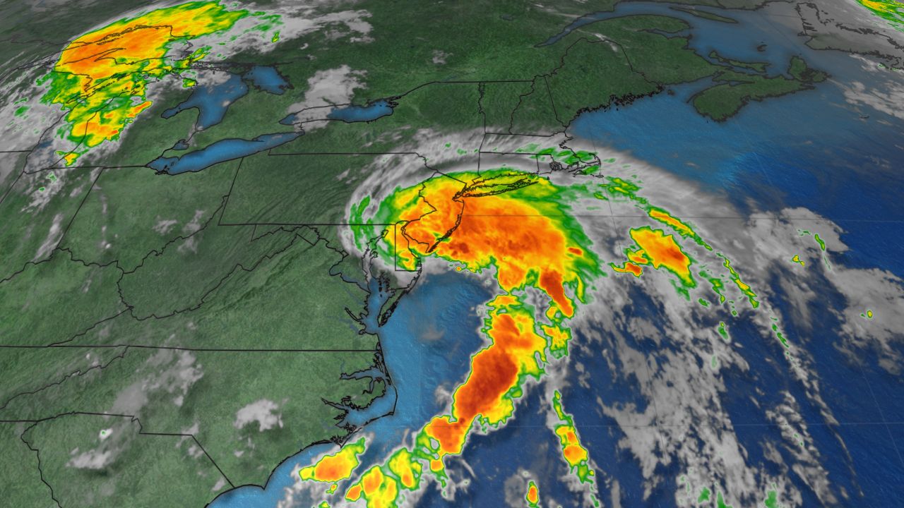
Tropical Storm Fay formed off the Outer Banks Thursday afternoon becoming the earliest an "F" has ever formed in the Atlantic basin.
On Friday afternoon, Fay made landfall near Atlantic City, New Jersey. It will continue to weaken as it moves farther north over land.
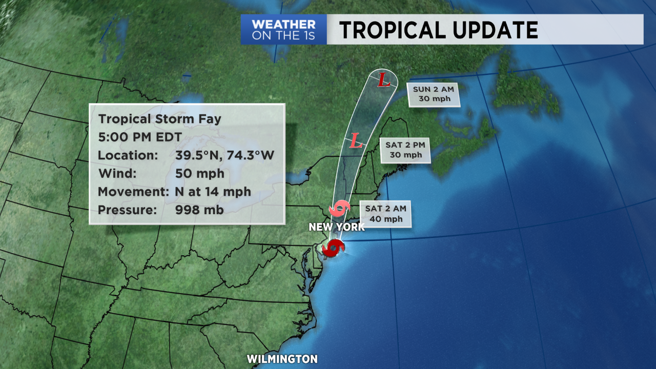
A Tropical Storm Warning and Flash Flood Watch has been issued for New York City. The Big Apple could experience wind gusts over 50mph Friday night and two to four inches of rain.
The storm is then forecast to weaken as it quickly moves over New England and into Canada through the weekend.