


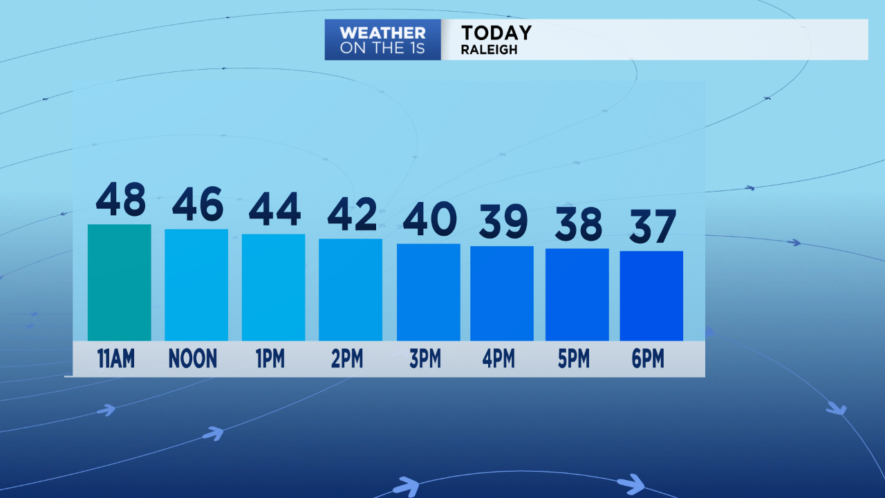
A cold front bringing rain to central North Carolina Tuesday will cause the temperatures to steadily drop through the day. Many locations will end up in the upper 30s and low 40s by mid and late afternoon.
Around 0.25" to 0.75" of rain is expected Tuesday. That rain should wrap up from west to east around 2 to 4pm.
As the rain is ending, it may briefly mix with sleet and snow. A quick burst of snow is even possible in a few spots near or north of the Triangle. Warm ground temperatures along with air temperatures still above freezing should lead to no accumulation.
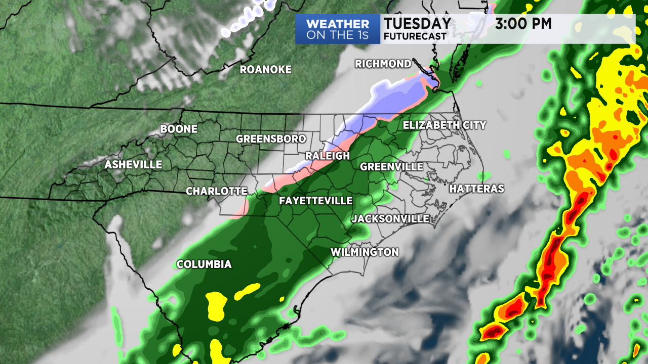
Roads will remain wet for the afternoon commute. As the winds pick up with gusts up to 20mph, the roads should dry quickly through the evening as temperatures drop below freezing.
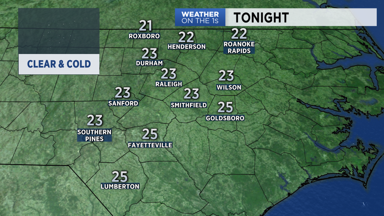
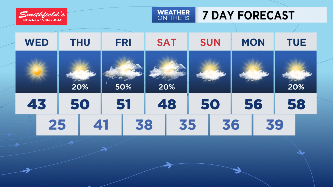
Lows in the low to mid 20s are forecast by sunrise Wednesday morning. The Triangle has a very good chance to tie the record low temperatures for the date. That currently stands at 23 from November 13, 1977.
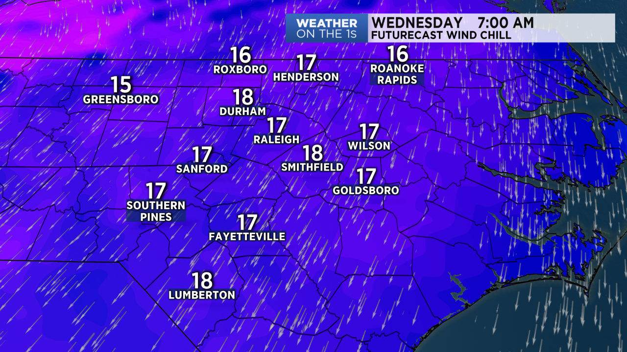
Gusty winds will make it feel even colder. Wind chills early Wednesday morning will be in the teen
Wednesday's highs will only warm to the low and mid 40s. Highs in the upper 40s to low 50s are then forecast for the rest of the week through the upcoming weekend.
We will see another chance for rain late Thursday night into Friday.
Follow Meteorologist Lee Ringer on Facebook, Twitter, and Instagram.