


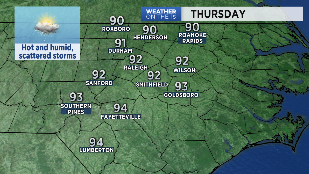
Another 90 degree day is expected across central North Carolina Thursday. Year-to-date, the Triangle has seen the 5th most 90 degree days on record.
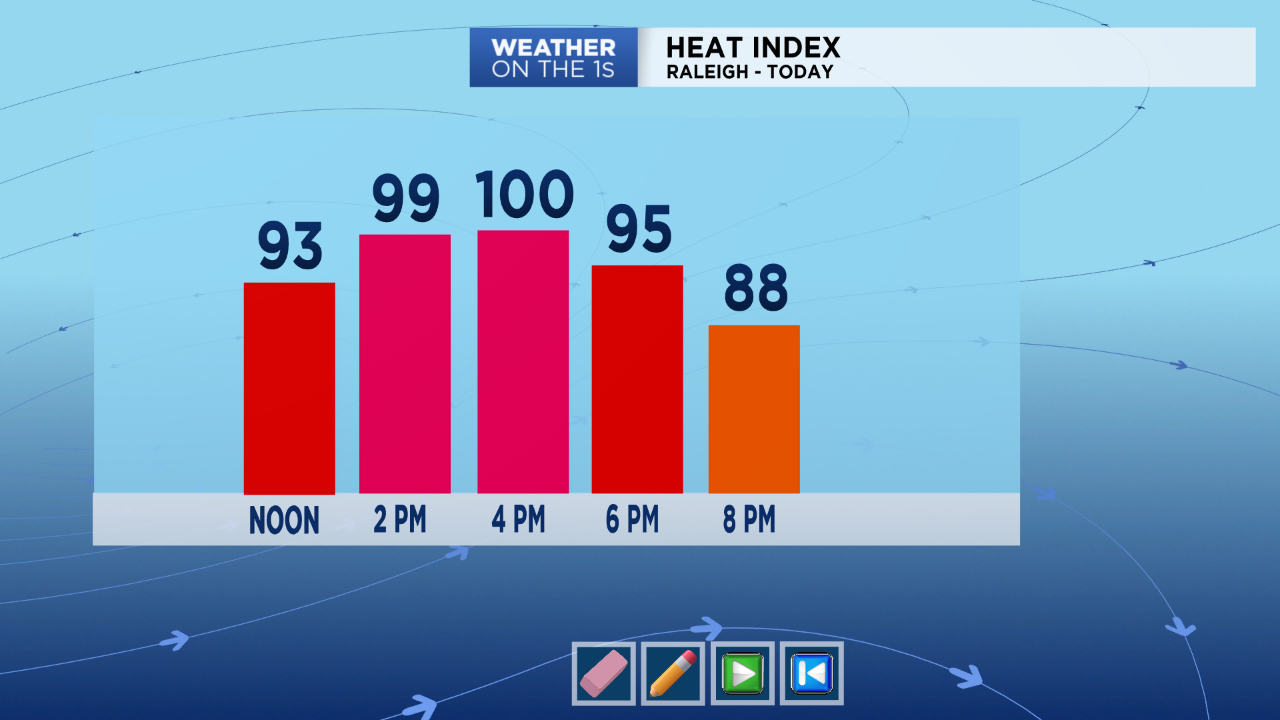
This afternoon's temperatures will range from the low to mid 90s, but the humidity will make it feel more like 100 or slightly higher.
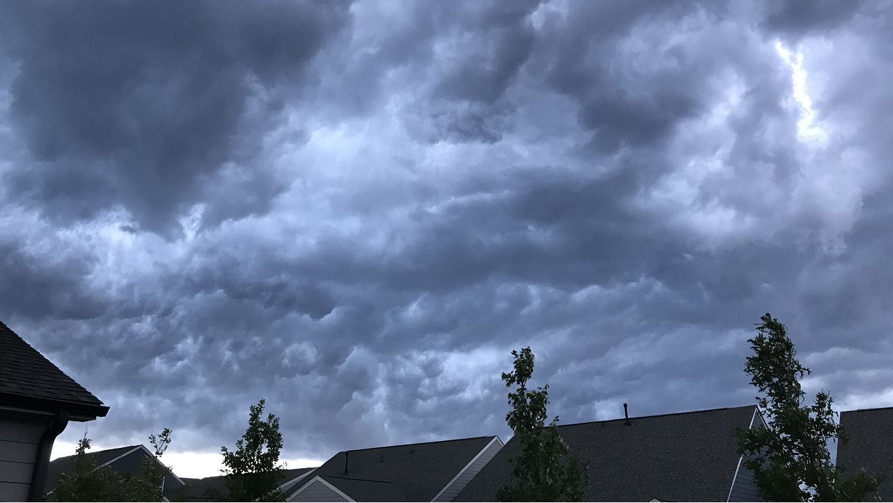
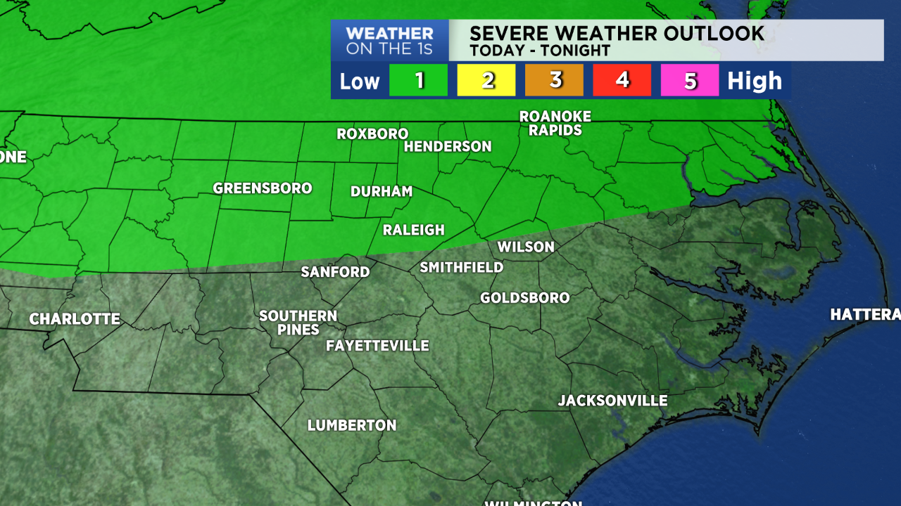
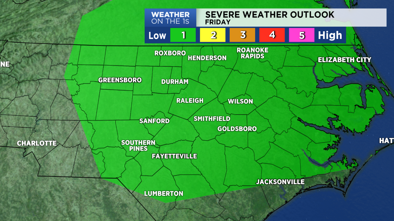
The heat and humidity should give way to more scattered storms starting after 3 or 4pm. While all of central North Carolina has a chance for storms, the greatest chance for a few strong storms will come for locations from the Triangle to the north. The Storm Prediction Center has outlined these areas for a low risk for a severe storm that could produce damaging wind gusts.
Thursday's scattered storms should come to an end by 11pm or so. There's just a slight chance for a storm lasting past midnight.
- Interactive radar
- Sign up for text weather alerts
- Share your weather photos with @LeeRingerWx on Twitter
More storms are likely for Friday afternoon and evening though as a front starts to move into the state from the north. Ahead of the front temperatures will return to near 90 in the afternoon. Fueled by the heat and humidity, some of the storms could again be strong. There is another low risk for severe storms for most of central North Carolina.
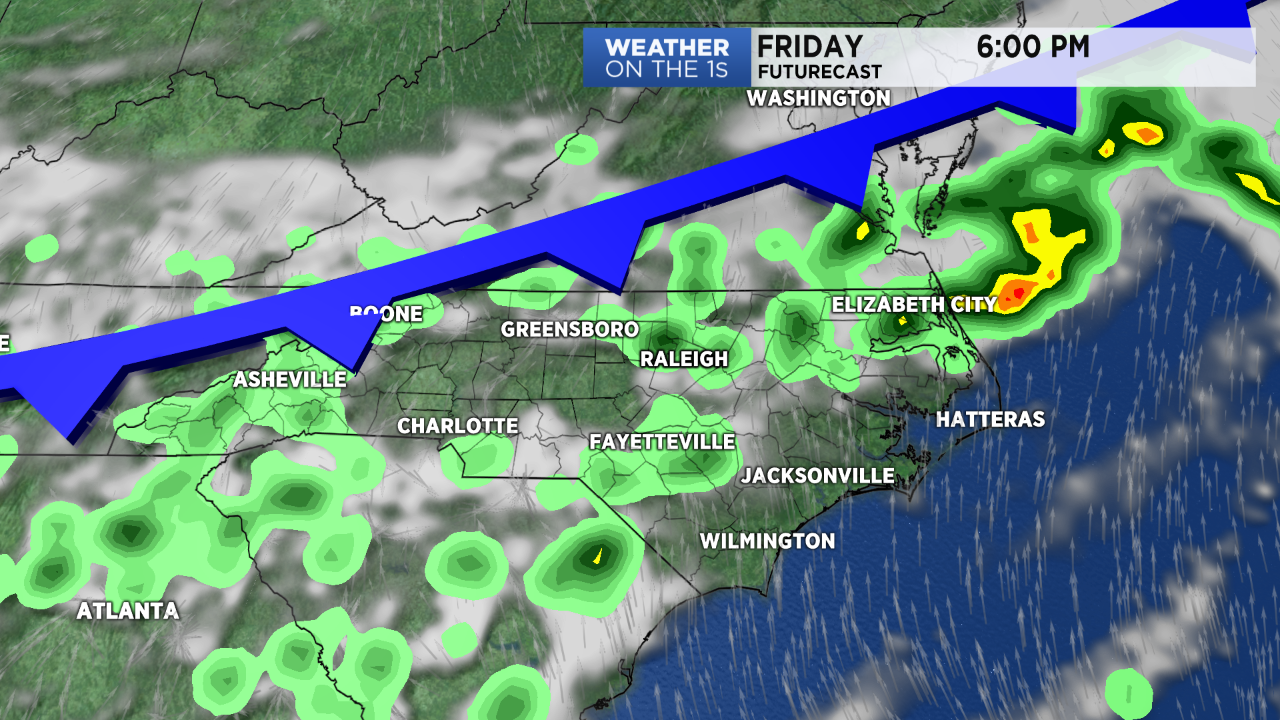
The strongest storms late Friday could produce damaging wind gusts in addition to locally heavy rain and frequent lightning. The storms could linger well into the night as the front slowly moves to the south across the Carolinas.
The front will finally bring cooler weather for the weekend. Temperatures will stay in the 70s for most of the weekend with highs just around 80 on Saturday and Sunday.