


After a few evening storms due to a passing cold front, we’ll all see calm and dry conditions overnight. Highs today peaked near 90 for most of the area. We’ll remain on the warm side overnight with lows only dropping into the upper 60s. This will lead to another mild morning for our Friday.
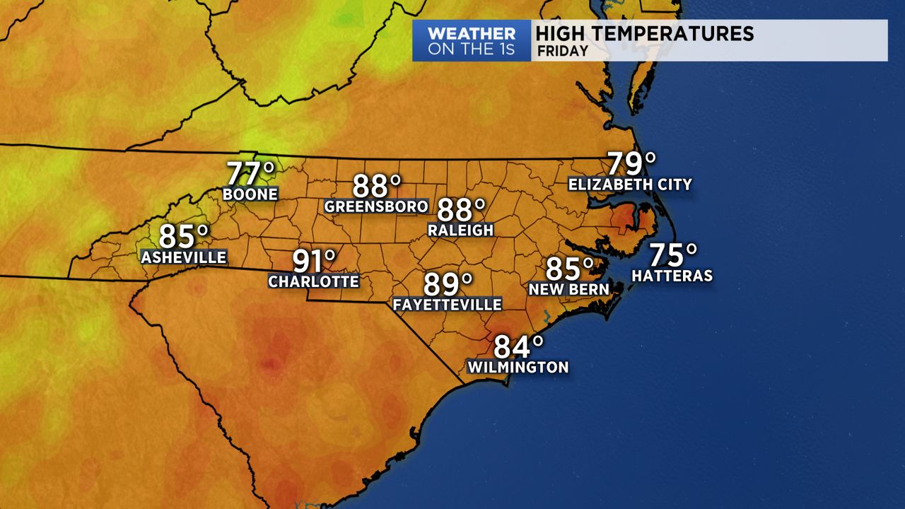
High pressure will quickly build in Friday behind today’s cold front. This means plenty of sunshine and a limited rain chance reserved for the coast. Friday will be not as hot as today thanks to a northerly wind behind the front. Expect highs in the upper 80s.
This weekend will feature plenty of sunshine as the area of high pressure moves east and sits just offshore. This new position will cause winds to shift and become southerly. Southerly winds through the weekend will cause a warming trend and sadly increase our rain chances too. Saturday looks to be the dryer day this weekend. Temperatures will range from the upper 80s to low 90s during the afternoon. Expect mostly sunny skies Saturday and mostly sunny to partly cloudy skies Sunday. Sunday will likely include isolated to scattered storms during the afternoon hours. A few storms may produce strong wind gusts and heavy rainfall. Widespread severe weather is not a concern.
After the weekend temperatures will continue to climb. Afternoon highs Monday through Wednesday will range between the low to mid 90s. Heating through the day will likely lead to a few storms each afternoon so keep your umbrella within arm’s reach just in case!
Get the latest news, sports and weather delivered straight to your inbox. Click here to sign up for email and text alerts.