


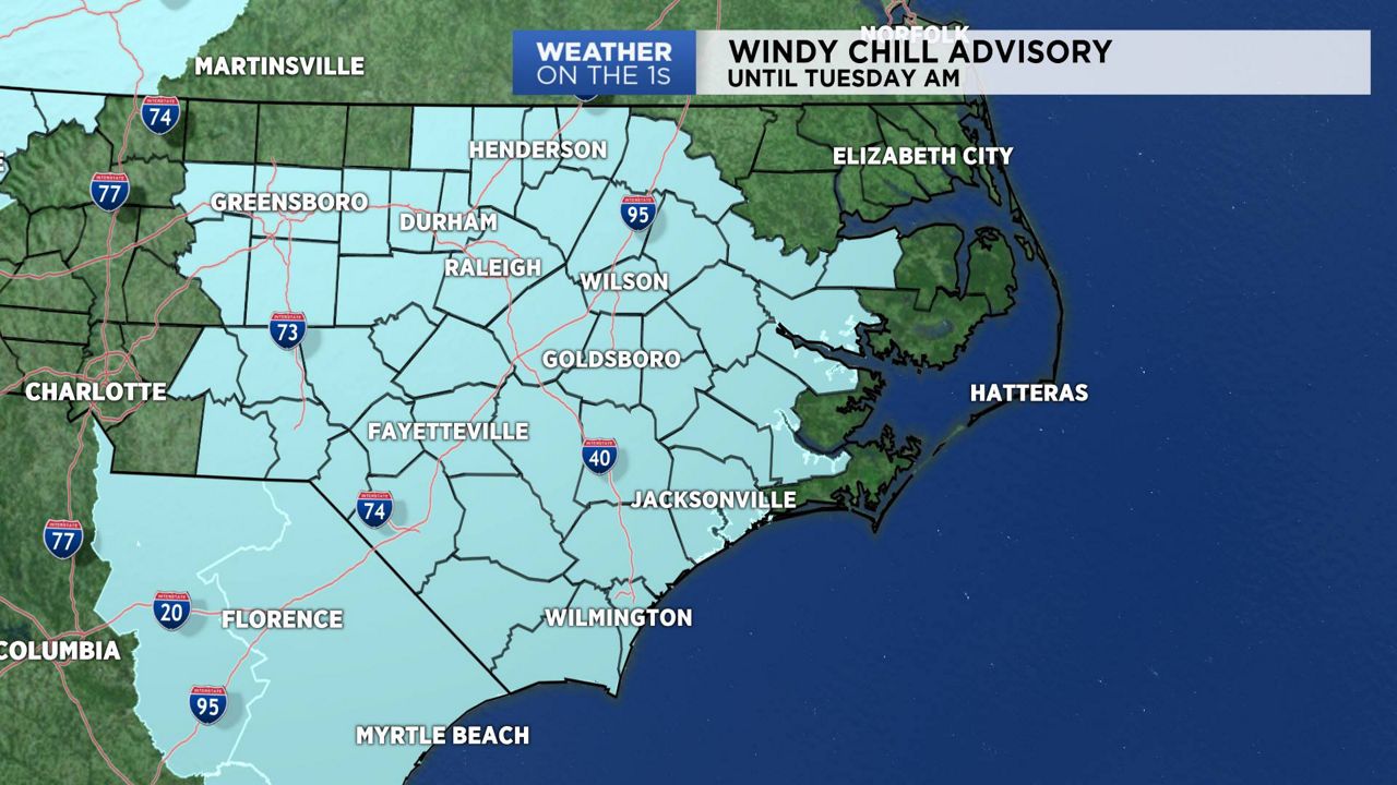
Cold air has settled into North Carolina and it is here to stay for awhile. Arctic high pressure will drop temperatures into the teens overnight into Tuesday morning with wind chills near zero.
A Wind Chill Advisory is in effect for much of central and eastern North Carolina overnight into early Tuesday morning. If you have to go outside, be sure to dress in layers to protect yourself from the cold. Even with a full day of sunshine on Tuesday, daytime highs will run well below average for early January.
The development of a coastal low could impact the weather across parts on the state on Wednesday. Models are currently pointing to the greatest chance of wintry precipitation across the coastal plain. That precipitation is forecast to develop during the day on Wednesday and end late Wednesday night. Any change in the track or strength of the system could significantly change the forecast. We will continue to monitor the forecast and make updates as needed.
Be sure to watch Spectrum News or click here for your latest local forecast.