


Although Tropical Depression Fred is weakening, it is still bringing intense weather to parts of North Carolina.
What You Need To Know
- The remains of Fred will track slowly north/northeastward
- Tropical downpours could lead to flooding
- The east side of the storm could bring isolated tornadoes
The remnants of Fred will bring some tropical downpours, which could lead to flooding.
An extremely humid airmass is in place, and the approach of what's left of Fred will only deepen that tropical moisture.
Areas of showers and storms will remain a good possibility today, and many of the showers and storms will be very effective rain producers.
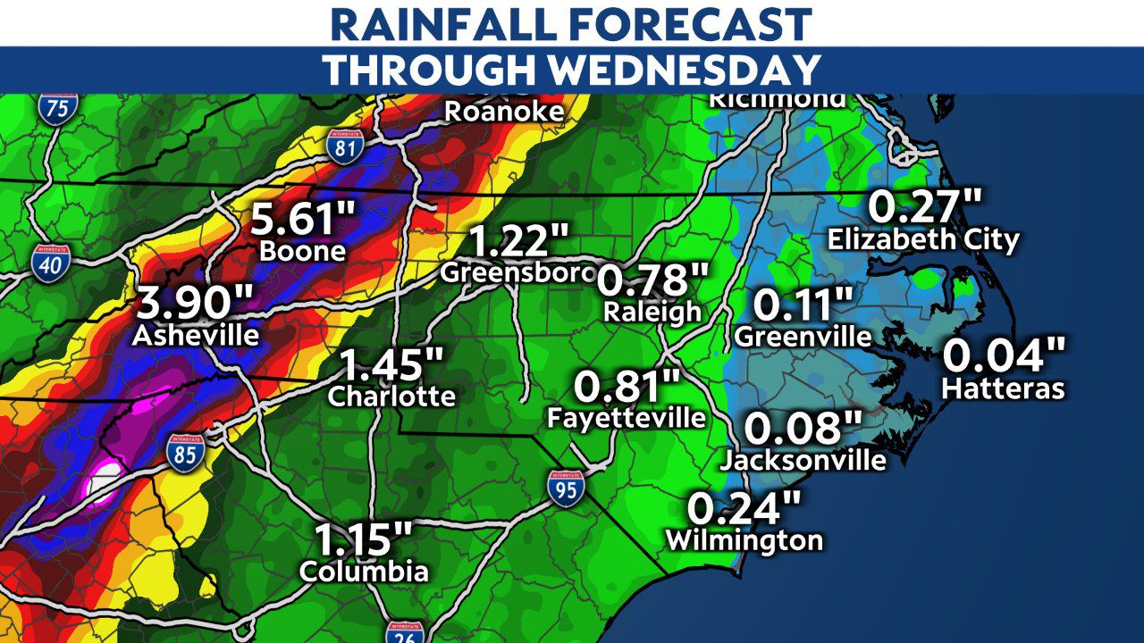
Many locations in the mountains and foothills will likely pick up a total of 3-6 inches of rain with locally higher amounts. From 1-3 inches of rain look possible across much of the piedmont.
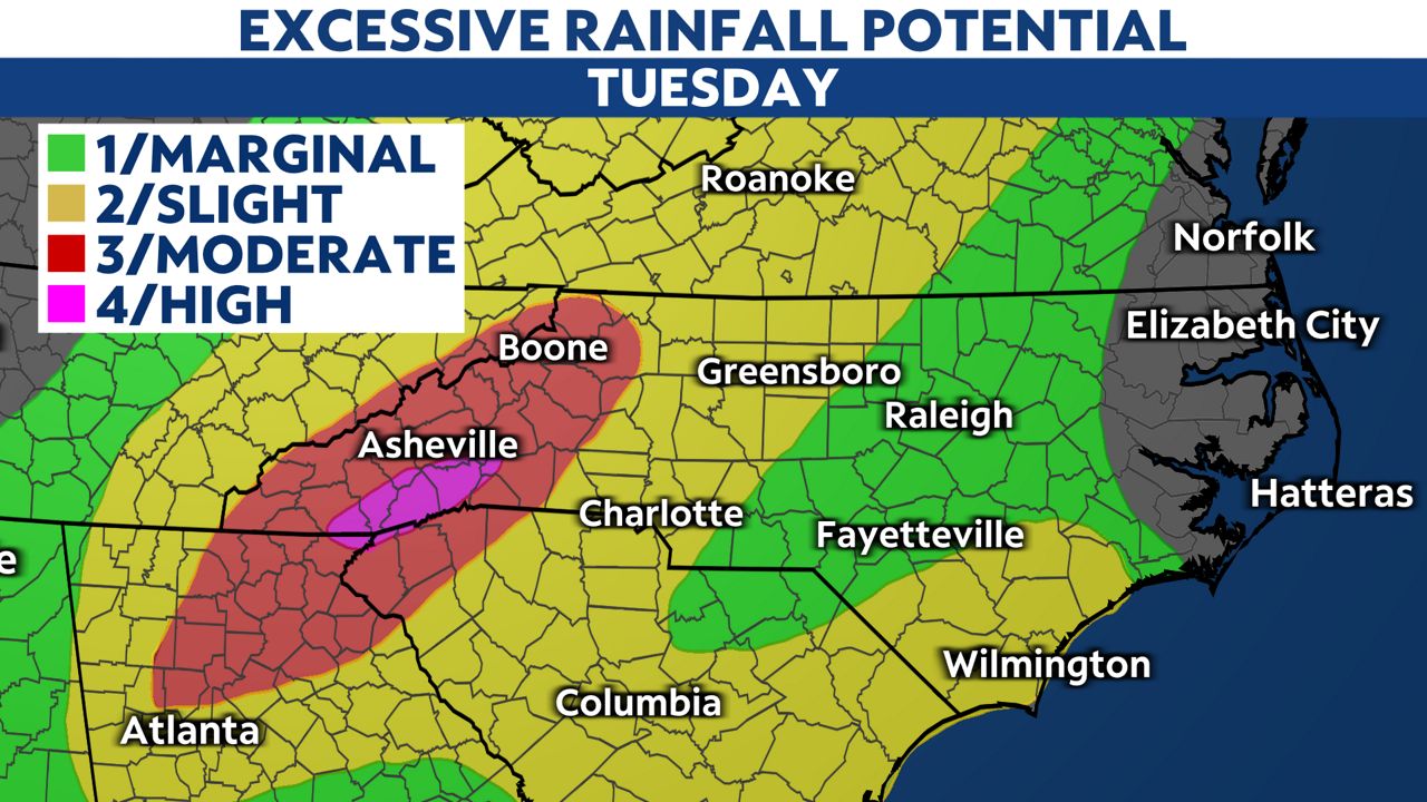
Flash flooding potential will remain across western North Carolina through Wednesday morning, and we will continue to have a growing potential for some mountain mudslides as well.
)
Remember that flash flooding is the deadliest severe weather hazard. If water is covering the road, turn around, don't drown.
Along with the rain threat, there is a chance for isolated tornadoes with the system through early tomorrow morning.
Like with the heavier rain potential, any tornado threat will be greater across the western parts of North Carolina. The Storm Prediction Center has areas west of US 1 in that threat for isolated tornadoes.
We've already seen several tornado warnings in western N.C.
The wind from Fred will quickly weaken as the storm interacts with land, so strong gusts won't be our biggest problem.