


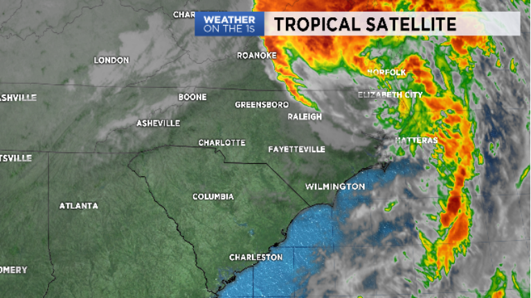
There is a diminishing threat from Michael across Eastern NC as the storm departs further northeast and away from our state. Western NC is free of the storm with some flooding issues that will go on into the overnight hours
- Gusty winds will remain an issue into Friday morning
- River levels are on the rise into the weekend across eastern NC
A clearing sky and colder air will be arriving through the overnight hours. Fall is arriving, finally, here in NC.
Gusty winds will be problematic overnight and early Friday morning. Mountain counties are at most risk for stronger winds overnight. Power outages are being caused by downed trees. Please do not attempt to move down power lines. Better yet, stay as far away from downed lines and report them to your local energy company.
Flooding and flash flooding were an ongoing problem throughout Thursday. Piedmont zones and northeastern NC can expect a risk for more flash flooding and rising streams as the storm departs. River levels will be on the rise into the weekend across eastern NC. Some flooding is likely to occur.
Please don't attempt to cross any flooded roads. There is no way to tell if the road bed is even still in place. With darkness, things can become even more dangerous. Remember, "TURN AROUND! DON'T DROWN!"
The good news? The storm will move offshore later tonight. After that, conditions will improve dramatically with sunshine and pleasantly cooler, fall-like weather for Friday and the weekend.
Get the latest news, sports and weather delivered straight to your inbox. Click here to sign up for email and text alerts.