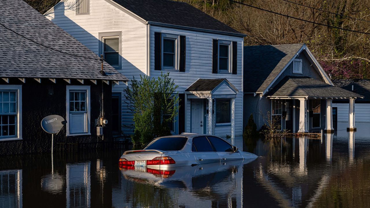
FRANKFORT, Ky. — After days of unrelenting downpours swelled rivers to near record levels across Kentucky, residents closely monitored waterways Tuesday for signs they had crested, but freezing temperatures could complicate any cleanup efforts.
Freeze warnings were in effect into Tuesday morning in much of Kentucky, along with parts of Illinois, Indiana and Missouri, with temperatures dipping below freezing in some places, according to the National Weather Service. A freeze watch has been issued for Tuesday night into Wednesday morning with subfreezing temperatures possible, down to the low 20s in some places.
“This is going to be a dangerous night where temperatures fall, where it gets potentially below freezing, so if you’re somewhere that’s very wet, if you’re trying to ride this out in a home that’s had water, tonight could raise concerns of hypothermia,” Gov. Andy Beshear, D-Ky., said during a news conference Monday, urging residents to find a safe place to stay.
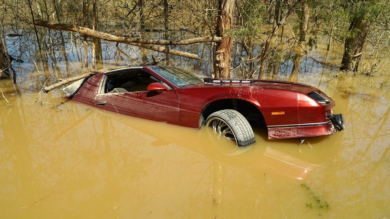
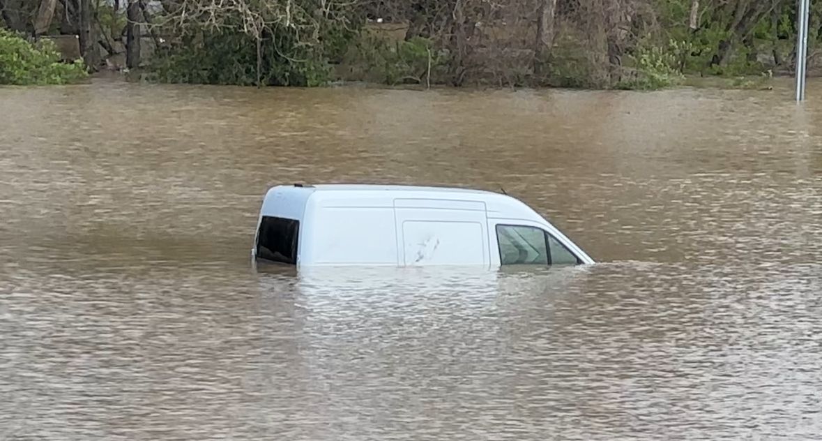
Inundated rivers are the latest threat from persistent storms that have killed at least 23 people since last week as they doused the region with heavy rain and spawned destructive tornadoes. At least 157 tornadoes struck within seven days beginning March 30, according to a preliminary report from the weather service.
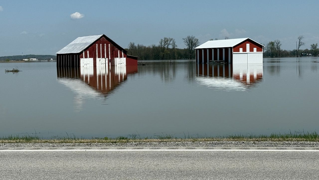
Though the storms have finally moved on, the flood danger remains high in several other states, including parts of Tennessee, Arkansas and Indiana.
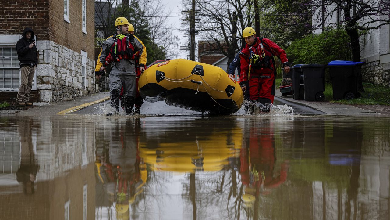
Cities ordered evacuations, and rescue crews in inflatable boats checked on residents in Kentucky and Tennessee, while utilities shut off power and gas in a region stretching from Texas to Ohio. Floodwaters forced the closure of the historic Buffalo Trace Distillery, close to the banks of the swollen Kentucky River near downtown Frankfort.
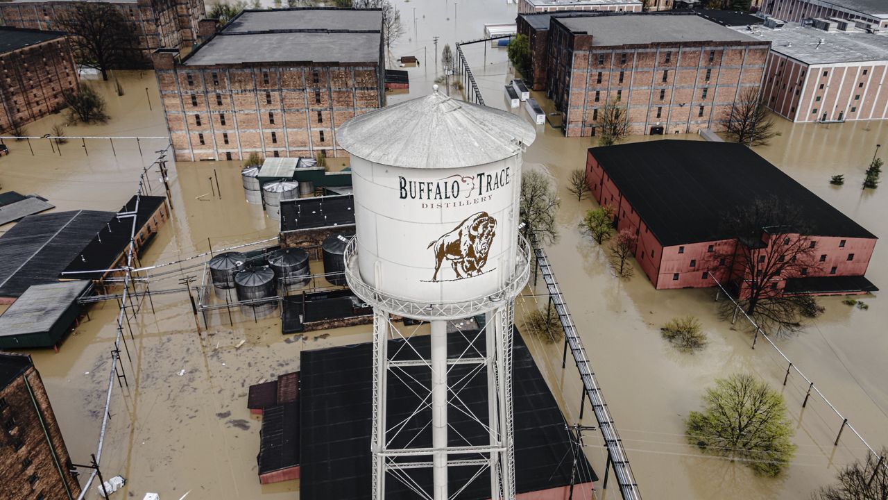
Officials diverted traffic, turned off utilities to businesses and instituted a curfew in Frankfort as the river crested just short of a record Monday. More than 500 state roads across Kentucky were still closed Monday evening, Beshear said.
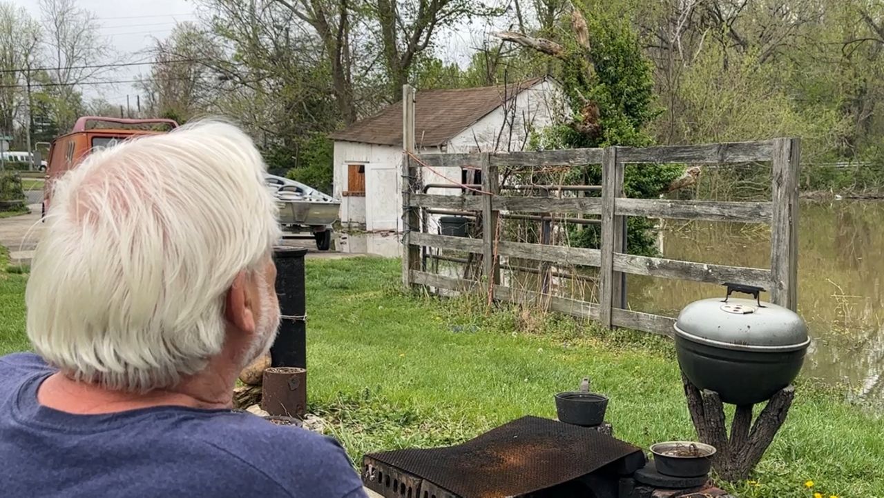
Several miles north of Frankfort, RVs were parked at a makeshift campground Monday after fast-rising floodwaters chased a community of 90 RVs out of a park along the Kentucky River on Saturday. Everyone made it out safe, although a few RVs had to be left behind and were quickly submerged.
“It was quite an ordeal to just kind of wake up, hit the ground and start running, make sure everybody was off the property, not only people but the equipment and the RVs,” said Traci Yoder, manager of the RV park and a resident herself.
Storms leaving devastating impact
The 23 deaths reported since the storms began Wednesday, include 10 in Tennessee. Among the four confirmed killed in Kentucky, a 9-year-old boy was caught up in floodwaters while walking to catch his school bus.
The deaths also included a 5-year-old boy in Arkansas who police said died after a tree fell on his family’s home, and a 16-year-old volunteer Missouri firefighter who died in a crash while seeking to rescue people caught in the storm.
The Kentucky River crested at Frankfort Lock at 48.27 feet (14.71 meters) Monday, just shy of the record of 48.5 feet (14.8 meters) set there on Dec. 10, 1978, said CJ Padgett, a meteorologist with the weather service’s Louisville, Kentucky, office.
Beshear said more than 1,000 people had no access to water and nearly 3,000 were under boil water advisories.
Why so much nasty weather?
Though significant rains have ended in the Southern Plains and the Mississippi, Tennessee and Ohio valleys, flooding on most rivers will persist this week, with some smaller waterways receding in the next few days, according to the weather service.
Forecasters attributed the violent weather to warm temperatures, an unstable atmosphere, strong winds and abundant moisture streaming from the Gulf.