


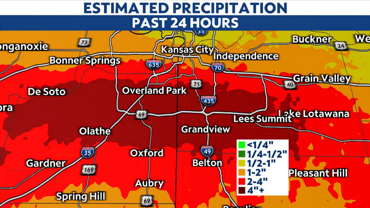
A storm system brought two to six inches of rain across the southern part of Kansas City Monday morning. The rain fell over a few hours time, leading to flash flooding along major roadways.
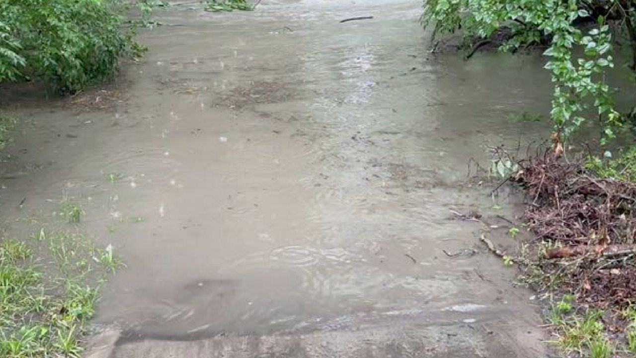
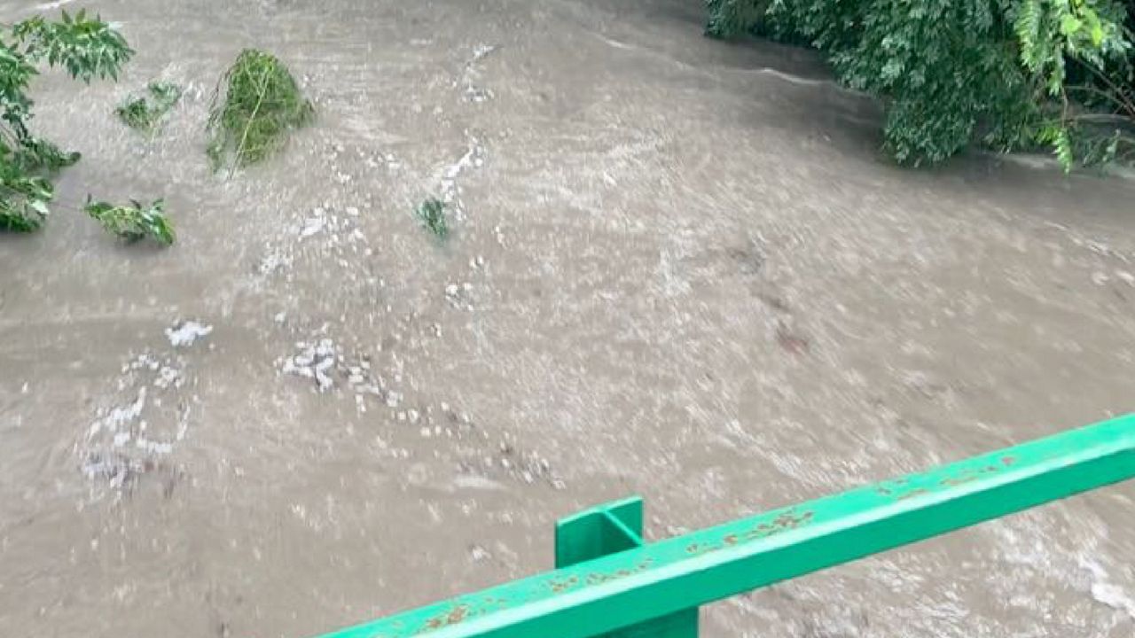
The hardest hit areas include Lee's Summit in Jackson County, Missouri and Overland Park in Johnson County, Kansas. Several creeks and streams toppled their banks leading to stranded cars and vehicle rescues.
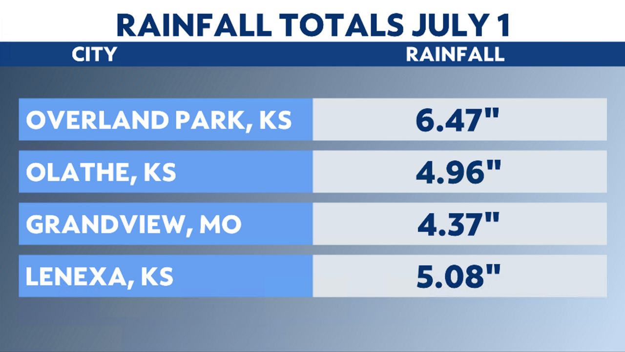
A warm front lifting through the region during the morning hours. As it did so, the moisture was enhanced, leading to "training" storms, or storms that moved over the same area. While not severe, the storms put down heavy rain in a few hours, exceeding six inches in some locations.
Several streams and creeks rose out of their banks, including Indian Creek, Tomahawk Creek and Blue Creek spilling on to major roadways. I-435, I-470, I-49, US-50 and US-71 all reported flooding by midday.
The entire system is expected to weaken as it moves east into central Missouri. Flash Flood Warnings remain in place through Tuesday afternoon.